
Wrong Way Peach Fuzz
MST. Chapter 26. Segment 9

This is my serialized story of hiking the Mountains-to-Sea Trail (MST), a 1,175-mile route that crosses the state of North Carolina. I’m hiking west from Jockey’s Ridge near Nags Head on the Outer Banks of the Atlantic Ocean to Kuwohi (formerly Clingmans Dome) near the Tennessee border in the Great Smoky Mountains. If you’d like to start at the beginning of my story, click here.
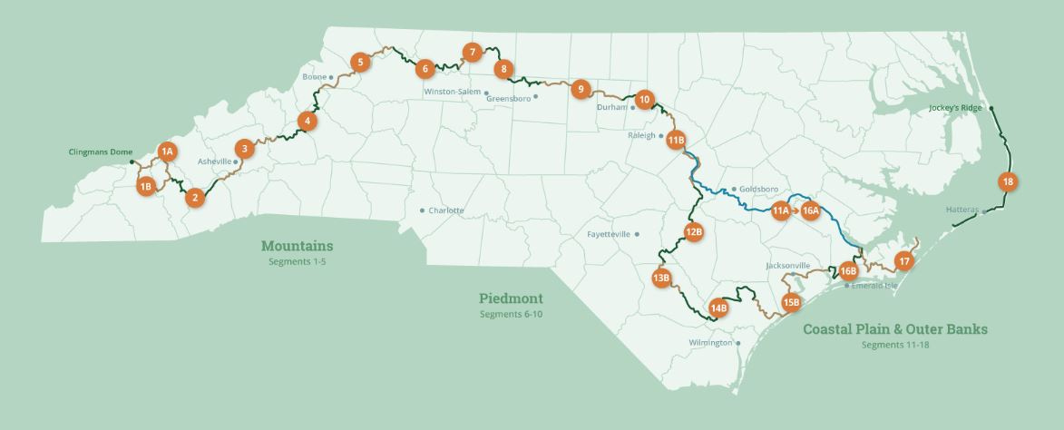
See the Mountains-to-Sea map at the bottom for reference.
Ugh! I don’t think I realized how tired I am, but once I start hiking down the trail to return to the Eno River, the tiredness kicks in within the first quarter-mile, or rather, it washes over me like a sudden wave of exhaustion. I think about turning back, but my daughter Helen has already driven away from the trailhead parking lot, and I am loath to call her on my cell phone to turn around and pick me up.
My goal today is to complete the last three miles of Segment Ten along the Eno River and then hike the first twenty miles of Segment Nine, which will include a lot of roads, a short trail, and a nice greenway around Hillsborough, North Carolina.
I am hiking one week after my seventy-five mile/four-day push up the western shoreline of Falls Lake and along the Eno River, north of Durham. This is the start of the three-hundred-mile Piedmont section of my Mountains-to-Sea adventure. I have walked five-hundred miles through the Eastern section of the MST and as I must tackle the Piedmont before I get to the Great Smokey Mountains my challenge is set.
I am tired though. Maybe that last stretch of slogging all day in driving rain on the narrow, flooded trail beside the surging Eno River took more out of me than I realized.
Then again, maybe it isn’t tiredness, but rather a sense of what it means to walk past my house heading west. Up until now each step in the East brought me ever closer to Durham, where I live about three miles from the trail. From this point on, each step will take me further away. A week ago, when my wife Karen picked me up, it took her five minutes. Now, before Segment Nine is completed, I’ll be at least an hour away by car. The distances will only get longer as I tackle the remaining eight segments.
The weather window looks perfect for hiking Segment Nine. For me, backpacking in winter and, now, spring has proven to be a perfect time of the year. That said, I know the heat of summer is coming, and I will need to reach the mountains or I will not be able to continue my journey until the Piedmont temperatures drop to a safer level.
Today, though, is one of dark rolling clouds under a blue, spring sky. Blustery winds provide a chilling, wintery contrast to a hot, intermittent sun.
With my home so close to the MST, I decide to hike the first twenty miles of Segment Nine as a day hike using a small pack to carry water and protein bars. The plan is for Karen to pick me up before nightfall. My hike will take me to the end of the Eno River Trail at Pleasant Green Road and the conclusion of Segment Ten of the MST. Once there, the trail directions have me hiking up to Route 70 for a tough four miles on the busy road between Durham and Hillsborough. My morning goal is to get to the Weaver Street Market, a great grocery store located just a few yards off the MST in Hillsborough, where, if I am lucky, a hot lunch and coffee await.


A week after the significant storm, the trail to the west looks like it has recovered, though I still skirt puddles of standing water. But, the walk along the Durham quarry, once a key source of water for the city, is lovely and the quarry seems more beautiful than I recall from previous occasions. The remaining three miles of the trail to Pleasant Green Road is a nice way to start the hike, though I know what lies ahead.
At the end of the Eno River Trail, white blazes, or even MST signs, totally disappear. Thank goodness for the guidelines I had printed off for Segment Nine and the Far Out app on my cell phone. Still, I know where I must go. Route 70 stands in my way, as it has on many other occasions coming off this part of the trail. This time I am prepared to hike it. Thankfully, the mid-morning traffic isn’t nearly as bad as rush hour or lunch time traffic. Still, trucks and SUVs whiz by me, but, by now, having walked miles of road on the MST, I am a road warrior.
An hour later at the Eno River Bridge on RT 70, I cross over the guardrail and climb down the embankment. Here, too, the signage is skimpy, but after standing for a few minutes in the dim light, I see MST’s white blazes on several rocks and trees.
I understand that an alternative route will one day take hikers from Pleasant Green Road onto a new section of the Eno River Trail all the way up to Hillsborough. Hopefully this will happen soon as Route 70 on this section of Segment Nine is not much fun, and, with the brim of the road crumbling in spots, more dangerous than I realized. I decide, as I walk on the trail to Hillsborough, its never the first car to worry about—the driver in the first car sees you and, more often than not, moves over to the middle of the road. Rather its the drivers in the second or third car who inevitably are following the first car too closely and don’t realize until its almost too late that they are approaching not just any old hiker but me on the side of the road. It’s those cars I worry about and stay prepared to jump out of the way.
I like being along side of the Eno once again. Presently, the trail turns into a paved greenway and the rest of the walk is easy with displays showcasing the town’s history.
Still, when I get to Weaver Street Market in downtown Hillsborough. I am tired of hiking on such a blustery morning. I have walked ten miles, but I am beat. I eat a vegan burrito and drink two cups of coffee before deciding to call Karen early. She is happy to pick me up with the Market only twenty-five minutes away and takes me back home for an afternoon of working in the garden. This, then, is the joy of day-hiking: going home and doing something else if you are beat!
I decide I will hike the second half of my proposed twenty-mile “day hike” by walking thirteen miles tomorrow. This time I will go from Hillsborough to the mill town of Mebane. Though, I recognize when I get there, I’ll still have forty miles to hike before reaching the end of Segment Nine. Still, I can’t help but feel I getting the best of both worlds: day-hiking the first twenty miles, and then, tackling the remaining forty miles with a two-day hike and an overnight camp along a new river for me: the Haw.
The next morning, before the start of my second half-day hike, Helen drives me back to Weaver Street Market in Hillsborough. It’s early and we enjoy a nice breakfast before she departs. This is definitely the way to hike the MST. Too bad the Weaver Street Market isn’t located all along the trail.


Hillsborough’s has many displays highlighting the history of the town along the greenway. Its roots extend back to the native Occaneechi people who settled in the area and traded with other tribes along the Eno, Haw, and Neuse Rivers. Later as Europeans moved into the area, many of the trails along the rivers became roads. Subsequently, at certain locations where fording these rivers was possible, towns were established, like here in Hillsborough, to handle commercial trade and travelers heading east and west. From these towns in the late 18th Century and into the 19th Century many water-powered mills, such as the one here on the Eno, were built to grind cornmeal and wheat or saw timber for farmers settling into the countryside. By the mid-19th Century, before the Civil War, railroad tracks were laid following the roads, with several railroads still active today. Most trains, though, have shut down as highways, such as I-40 and I-85, have been built to carry goods and services across the state.
Prior to the Revolutionary War Hillsborough and the surrounding area was a hotbed for the Regulators, colonists who rebelled against taxation under British rule. This series of “skirmish” began almost ten years before the Revolutionary War and was put down by the British five years prior. Speaking of the Revolution, one of the signers of the Declaration for Independence, William Hooper, lived in Hillsborough. His house is one of a hundred houses in the town still standing from that period. As such, Hillsborough was a key location for the gathering of the North Carolina Assembly in 1780s, out of which the final site for the state capital was chosen: it was to be a new city located near the larger Neuse River with “Raleigh” agreed upon as it’s name.
As someone who loves history, this half-day walk is perfect. I enjoy reading the displays and learning more about Hillsborough’s history, especially without the pressure of hiking twenty miles or more to get to the next campground.
I follow the Eno out of town heading west, but when the river turns north once and for all (coming down from its confluence in northern Orange County), I leave the Eno behind and begin my trek toward the Haw River watershed and North Carolina’s modern industrial history. I walk roads for the next ten miles, and by the time I reached downtown Mebane, with its cafes and boutique shops in its aging brick buildings, I am ready, once again, to call home.


A week later, my daughter drives me back to Mebane and we share a cup of coffee at Filament, a nice coffee shop, which the MST passes on the town’s main street. It’s the perfect way to get started, I swear, and soon, I say goodbye to her, once again, and start my journey westward. This two-day hike will complete Segment Nine and I am happy to get started. The half-day walks were a nice reprieve, but I also feel like I spent two days on the trail and only managed twenty miles.
This time I will hike approximately twenty miles a day and camp at a primitive campground at one of the state’s recreational area along the Haw River. With the roads I have walked so far, I am not sure what to expect for tonight. Still, after ten miles, when I reach the town of Haw River, I am delighted to see that the directions have me walking seven miles of trail along the Haw River. This is more than I expected and I rejoice in my good fortune.
The old Cone Mill at the town of Haw River is emblematic of the mills I have encountered on my hike. The Haw River, itself, is more substantial than the Eno River. Over the past two centuries it has been dammed repeatedly to generate power for numerous mills along its route. In the later part of the Twentieth Century, when electricity replaced water-driven generators, many of these mills were shuttered. In fact, the Haw River is no longer a harnessed source of power for the textile industry.
As a result, the Haw River has become one of North Carolina’s most famous paddle trails and, more recently, the state is helping to create a much longer hiking trail along its banks. Though still in the works south of the town of Haw River, one day the Haw River Trail will continue down river twenty miles to Saxapahaw, or even, all the way to where it empties into Jordan Lake. This, in the future, will impact the Mountains-to-Sea Trail and lead hikers south to Saxapahaw (and away from the roads I just walked) before returning to the current trail outside of Hillsborough.


Several miles later I encounter a shuttered mill that was the site of a major fire in the fall. The trail behind the building is closed off, but with no one around, I continue following the river and walk past the decimated facilities.


Soon I reach the historic town of Glencoe, a site unique to North Carolina. Through much effort, the town has been restored to how it looked when it was a thriving mill town along the Haw River. Typical of many mills, the town was established precisely to house the workers and to provide for their provisions and basic needs. One could live one’s entire life in Glencoe in the late 1800s under the supervision of the company-owned mill. This, it seems to me as I walk through the town, could be subject to abuse, especially when 70% of the work force were uneducated women and children.


The Haw River Trail (and the MST) continues past Glencoe, and I pass a number of recreational areas and primitive camp sites. At one spot I follow the trail between the river and a golf course. This is a first for me as I watch golfers in their carts staring at me as I walk along the edge of several fairways.


Late that afternoon I reach the Shallow Ford Natural Area where I have reserved a campsite. I have already walked twenty miles and discover upon entering the reserve that my campsite is still two miles deep in the reserve. It turns out it’s located far from the sound of traffic and day-hikers but still near the Haw River. In spite of the extra miles, it’s a lovely spot to end the day and I am thrilled to be totally alone.
I put up my tent but leave the rain tarp off as no rain is expected for tonight. I have a beautiful view of the forest canopy and the ascending moon. This feels like a magical spot until I realize that the limb directly above me is dead. Of all the places to pitch my tent, I am under the threat of death the rest of the night listening to the wind while waiting for the limb to drop. In the future, I tell myself, in addition to looking for a flat spot to put up my tent, I need to check the canopy too. Dah!
That is my first mistake. I discover a more significant mistake as I prepare to go to sleep. My cell phone indicates I am down to 17% power. I reach for my power pack and realize I have forgotten the cord that connects my phone to the pack. This is a huge error and the first time I have made this mistake on the entire hike—starting all the way back to Segment Eighteen on the Outer Banks.
I have another full day of hiking—twenty-three miles in all. This time with a phone that’s nearly dead. Not only is that a problem in telling Karen when to come get me, but it will impact my Garmin tracker for my family to follow my progress. So, too, it will impact being able to open the app to confirm the MST route or even use my camera phone. What a booboo! I call Karen and let her know, then turn off the phone. Tomorrow, with a dead phone, will be interesting.


I wake and see that I have 14% power on my phone. My goal, now, is to keep as much power on the phone as I can so I can call Karen at the end of the day. Again, I turn it off. The walk out of Shallow Ford is beautiful and the extra two miles to get back to the road is well spent. Soon I forget about my phone and am on my way—untethered. The walk on the country roads isn’t bad as I leave the Haw River behind.
I am down to one container of water with approximately twelve miles to go before reaching the next convenience store along the route. Not a difficult assignment, as I have been in this situation before, but it does mean that the convenience store must be open. Any deviation from this fact could be a problem.
The hike soon takes me to the old Guilford County Farm where incarcerated men farmed the fields for their produce. Now a recreational area, the trail goes into the fields and surrounding forests before popping out on the road near the Farm’s barns. Hiking in this reserve is a nice turn from walking roads. Still, without the Far Out app tracking the MST trail, I miss my turn in the woods and end up walking an additional mile before discovering my mistake. Adding two miles to my hike here, along with the extra two miles to start my day, makes for a much longer hike than I imagined. With a dying phone and a deadline for getting picked up, this is not a good turn of events and I fear I will pay for this in the end.
I pick up my pace and reach the small gas station/convenience store at a crossroad near McLeansville at around 11:30 AM. Now having walked fourteen miles with at least nine more miles to go, I am relieved to see it is open. Interestingly enough, it’s across from a golf course—my third one on this segment on the MST. I wonder if I could have gone into the club house to replenish my water? Could I pretend to be a golfer?
The convenience store clerk asks me how it’s going and when I mention my phone is nearly dead on top of having walked four extra miles, she points to a wall outlet opposite the counter where I can charge my phone. I tell her I don’t have a cord and, lo and behold, she hands me her iPhone cord from the shelf below her.
I am surprised and very relieved. Soon my phone is being charged as I sit in a chair opposite her drinking from a large bottle of water, one of two I just purchased to refill my backpack containers. The clerk, a dark-haired woman with a nice smile, is named Elizabeth and she is from this area. Everyone who comes into the store either for cigarettes or to pay for their gas seems to know her and soon I can see why—she has a vivacious, generous spirit about her. One could easily become fast friends.
I ask Elizabeth if, by chance, there’s any hot coffee for sale, and she says she cleaned the coffee area earlier—but, almost without pause, she says she will make me a fresh pot. Sure enough, in no time at all I have a full cup of fresh coffee along with a bag of Lays Classic potato chips and a Snickers bar, both of which I eat for lunch while waiting for my phone to charge.
Three cups of coffee later Elizabeth and I are the best of friends and my phone is nearly 50% charged. She says she sees a lot of MST hikers here but all of them are walking East. I tell her I am Wrong Way Peach Fuzz from the Rocky and Bullwinkle Show, but she doesn’t remember Wrong Way. Maybe I have the wrong show. Anyhow, with fourteen miles in and, perhaps, ten more to go, it’s hard to focus on the cartoon characters from my youth. Still, I swear Captain Wrong Way Peach Fuzz was in the Rocky and Bullwinkle show.
Thirty minutes later, I have to leave to make my rendezvous with Karen and I thank Elizabeth for being so helpful. She says she will walk from the mountains to the sea one day and I hope she does. Back on the road, the afternoon is a combination of farm land and small forest reserves. Most significantly, by 3:00 PM I have reached the end of Segment Nine. After hiking through construction of a new bridge over Highway 29, I stand in a soccer complex north of Greensboro with what appears to be more than twenty soccer fields—which, on this Saturday afternoon, are all full of kids.
This is the perfect spot to meet Karen, though we discover we still need our phones to triangulate. She has driven to soccer field #1 while I am at the MST trail head near soccer field #14. Who knew soccer fields could be so confusing! After walking twenty-four miles today, the extra hike to Karen at soccer field #1 is a breeze. With dozens and dozens of cars parked in the various lots, I can’t help but think of Elizabeth in the convenience store, a trail angel if I ever met one for letting me charge my phone.
When I reach our car, Karen rewards me with a bag of jellybeans. Shortly thereafter, we are on our hour-long drive home. The cities of the piedmont are nearly behind me and ever closer are the three-hundred-and-fifty miles of mountains I must traverse to reach the end of the Mountains-to-Sea Trail. Call me Wrong Way Peach Fuzz, but, slowly but surely, and with whatever energy I can muster, I’m going to get to Clingmans Dome.
Click here to read the next chapter.
Click here to read the previous chapter.
Map of the Mountains-to-Sea Trail. This post focuses on Segment 9.
I’ve enjoyed reading your blog, particularly the history of the lands and people on and near the trail. I hope you’ve had a chance to grab a copy of Jerry Barker’s new book about discovering the MST.
Happy Trails!
Celeste Queen
I remember wrong way peach fuzz!