


Scarce Commodities
MST. Chapter 17. Segment 15 (Part 4)

This is my serialized story of hiking the Mountains-to-Sea Trail (MST), a 1,175-mile route that crosses the state of North Carolina. I’m hiking west from Jockey’s Ridge near Nags Head on the Outer Banks of the Atlantic Ocean to Kuwohi (formerly Clingmans Dome) near the Tennessee border in the Great Smoky Mountains. If you’d like to start at the beginning of my story, click here.
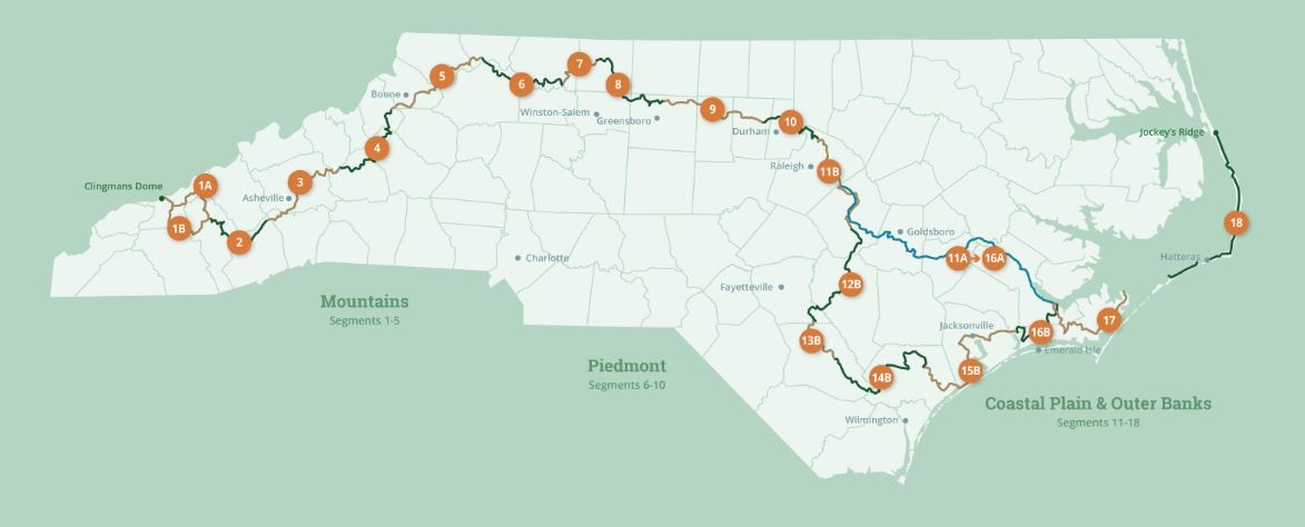
See the Mountains-to-Sea map at the bottom for reference.
Tim Supple is a big man in his early sixties and appears to be in good shape. Over dinner the night before at a local Mexican restaurant in Sneads Ferry, NC, he tells me he works at the local Ace Hardware store and is also renovating a house he owns. In addition to serving as the volunteer coordinator for this segment of the Mountains-to-Sea Trail, he and Cathy, his lovely bride, are foster parents of two two-year-olds. Clearly, I realize, he is a man who constantly stays busy.


So, too, he is a font of knowledge regarding this segment of the trail and what lies ahead; it’s obvious in hearing him discuss the game lands under his purview, I need to be better prepared if I am not to end up shriveled like a wrinkled prune. Essentially, after the coastline of Topsail and Surf City, I will be hiking inland thirty-five miles without means to water (other than what I am carrying), and I’ll be camping two nights (without access to water) while crossing the upcoming Holly Shelter Game Lands - all before reaching the next town. This, I’m thinking, just after my 70th birthday.
An eye-opening moment over fajitas, for sure. I recognize water has been a scarce commodity throughout this hike, but to be told this is a significant issue in the miles ahead from this segment’s trail coordinator brings its own profound sense of reality.
No wonder Tim has never seen a backpacker my age attempt the trail. I don’t know why it has taken me so long, but now it’s dawning on me that this hike has been (and continues to be) much more serious than I ever imagined.
Tim is quick to say things can evolve with the game lands. He tells a story of working with a team to establish the MST through the Stones Creek Game Lands I walked earlier that day and how it all had to be revised when the NC Wildlife Resources Commission allowed acres of pine trees to be logged. Having hiked through those open fields and having taken pictures of the cut, I can only imagine how shocking it must have been for Tim and his team.
The Mountains-to-Sea Trail is not part of the US Forest Service, NC State Parks Department, nor the Wildlife Resources Commission. It belongs to no NGO land conservancies in the state, yet it seems to find a way to slither through the lands they all maintain - sometimes even shedding its skin. Like a snake, the trail, now at forty years since it was created, winds along, continues to adjust, and endures.
A nicely dressed man stops by the table to say hi to Tim. They chat for a few minutes. Tim tells me later that he has lived in Sneads Ferry for thirty years and, to me, given how many times he waves at customers, he seems to know everybody in the town. From our conversation, it’s clear, too, he’s familiar with everyone in the State who has either been involved with maintaining the MST or hiked it.
In fact, he tells me, the person who holds the fastest known record for the MST, Tara Dower, also stayed in his RV. Her team of four or five people slept in his RV with her. To this day, Tara’s record of 29 days, 8 hours and 45 minutes hiking from Clingman’s Dome in the Great Smokies to Jockey’s Ridge on the Outer Banks, achieved way back in 2020, still stands.
That night, after Tim drops me off at his RV, I google Tara Dower and read about her MST accomplishment. She only wore a water vest, but she started each morning at 3 AM and averaged forty miles a day. My pace, carrying a thirty-pound backpack, is more like twenty miles a day. I hike to what campgrounds or motels I can find. Tara’s team, who were in a support vehicle carrying her supplies, were with her every day and helped her navigate around the remote stretches.
Now, looking ahead, I realize I, too, will need such help with the sections having significant distances between campgrounds or motels. The secret of the Mountains to Sea Trail, I tell myself as I go to bed, is working with the volunteer angels, like Tim, who can assist you, such as with transportation to and from the trail.
Early in the morning Tim drops me off at the Presbyterian church where he picked me up the day before, and I am back on my way hiking toward Topsail Beach. My plan is to walk the beaches, starting in North Topsail, and meet my wife and daughter at Surf City. As I start my hike, I realize I miscalculated the distance and, instead of ten miles overall, it’s fifteen miles to our meet-up point. I text them I’ll be an hour-and-a-half late and forgo the beaches in favor of Route 210, the only road on the island. A small but significant concession, but it’s hot, my feet are sore, and the summer season is upon me: vacationers are everywhere.


At one point I stop at a vegetable stand, the only store I’ve seen so far on my walk down Topsail Island, and ask if they sell Gatorade. A woman behind the wooden table says they just sell water. I go to buy two bottles, but realize from her sign over the cash register that they only take cash. This is okay, okay, as I have twenty dollars in my backpack.


As I begin to take off my heavy pack, an older woman slightly stooped over and fingering the zucchini, stops me and says, “that’s okay, young man, I’ve got it.” Young man! I don’t know if I am thanking her for buying the water for me or calling me young. I want to kiss her, but refrain just in time.

Meeting Karen and Helen is a relief and, finally, the end of my four-day journey on the MST. With my pack in the back of the car, we cross the sandy street to get tacos for lunch and I buy more water. Soon we cross over the board walk and lie on the beach, and I fall asleep in the sand to graying clouds and the sun splashing my face.
Click here to read the previous chapter.
Click here to read the next chapter.
Map of the Mountains-to-Sea Trail. This post focuses on Segment 15b.
Karen and Helen are an amazing support team for you. You are so blessed.