


Death on US Route 17
MST. Chapter 16. Segment 15 (Part 3)

This is my serialized story of hiking the Mountains-to-Sea Trail (MST), a 1,175-mile route that crosses the state of North Carolina. I’m hiking west from Jockey’s Ridge near Nags Head on the Outer Banks of the Atlantic Ocean to Kuwohi (formerly Clingmans Dome) near the Tennessee border in the Great Smoky Mountains. If you’d like to start at the beginning of my story, click here.
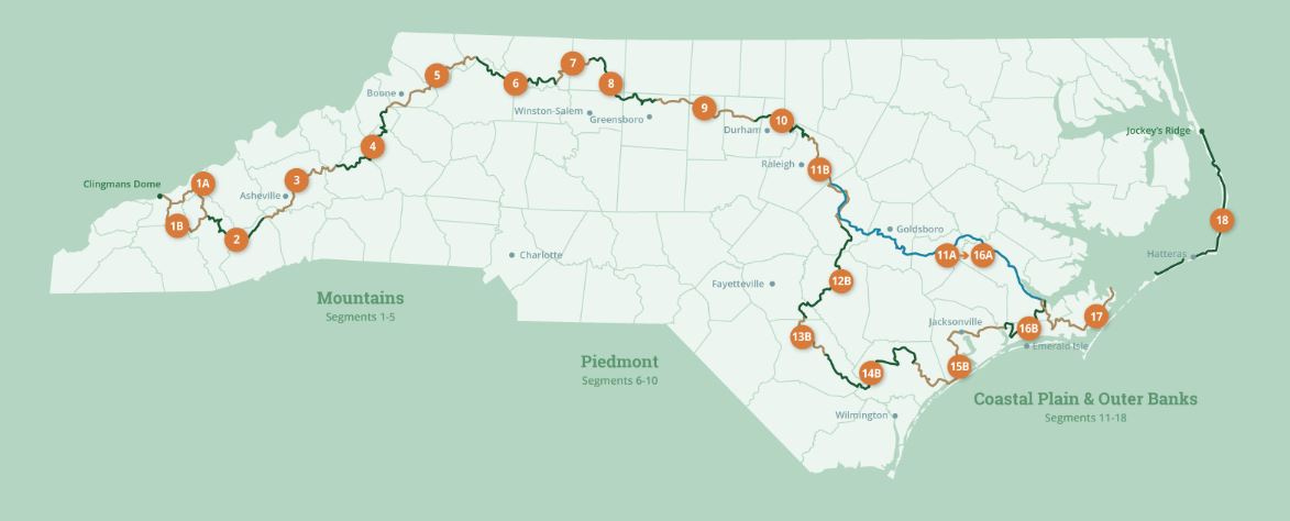
See the Mountains-to-Sea map at the bottom for reference.
Today I’ll leave Jacksonville and head down one last time to the Atlantic Coast. My goal is to reach Sneads Ferry just outside of the 26-mile island of Topsail. Tomorrow, as I continue on Segment 15 of my Mountains-to-Sea journey, I’ll be walking beaches for the final time from North Topsail to Surf City. Today, though, it’s a matter of getting there. A twenty-seven mile hike on country roads and one long highway is in store for me on this, my longest planned trek of my four-day hike.
I decide that it is a good thing to do such a walk today. My feet, so sore from the previous two days, are beginning to get tougher. From the opening day, the “what the hell are you doing now” blisters (barely worth mentioning) are less painful. I suspect if I kept walking all the way to Clingman’s Dome in the Great Smoky Mountains, the terminus of this MST hike, my feet would be as tough as nails, even tougher. Like alligator skin. Like craggy rock formed from molten blisters of past segments. This, I tell myself as I limp along, swallowing ibuprofen like candy.


I am tired of talking about feet. I want to ride in the monster truck outside of my Days Inn motel room. I want to hang out in the coffee shop I pass by on my way out of Jacksonville. Samantha, the owner, welcomes me as her first customer - she is opening her cafe on this very day. She’s been to Clingman’s Dome and shows me pictures from her phone. The pictures seem like a lifetime away from where I stand in Jacksonville. I order two shots of espresso with a small coffee. However, she discovers her coffee machine hasn’t been installed correctly. Still, the espresso machine is working just fine. I make it three shots.
This day has a good-end point to it. I am to meet the Segment 15 Trail Angel, Tim Supple, at 6 PM in Sneads Ferry. I contacted Tim to show me where I can camp, as instructed in the trail guide, but instead, when we correspond, Tim invites me to stay in his Airbnb/ RV. He puts up all MST hikers for free, he messages me. On top of that, he wants to take me out to dinner to hear my story as (yikes!) I am the oldest backpacker who has ever contacted him.
So the hike begins and soon the traffic on the highways and back roads becomes oppressive. On the country roads the pickup trucks and cars are manageable enough, though the roads often have very little brim to walk on, but the seven miles in the late afternoon, after having walked sixteen miles, now spent on the shoulder along the busy, divided highway of US Route 17, a double lane North/South expressway that takes people and commerce up and down North Carolina’s coastline, is wild. Walking with a thirty-pound backpack towards the oncoming traffic is almost too much to fathom. I can’t help but see my death - not falling from a Smoky mountain or drowning while swimming across a wide Neuse-type river (like I saw at the end of the Neusiok Trail), not meat for an alligator, or a bear (more in Eastern than Western NC and larger too) or trampled to death by a herd of deer, but smashed like a stink bug against the windshield of an eighteen-wheeler carrying beach umbrellas to Walmart.
The turn off the highway and onto a track of public game lands comes up out of the blue and is truly welcomed. Thank goodness for the directions I am carrying and the tracking map (on the app Far Out) that leads me at mile marker 23 away from the rushing traffic, several miles before the next exit, down and across a gulley, and, once more, into the solitude of woods. It’s crazy to just turn left off the highway, but, sure enough, there’s a gate and a trail a few feet into the woods and I feel like cheering for having successfully survived seven miles of Route 17.


Four miles later I’ve crossed the Stones Creek Game Lands and have reach the trail head at Sneads Ferry. The time is 5:30 PM and I have made it. I take the thirty minutes remaining before I am to meet up with Trail Angel Tim and sit in the shade of the Presbyterian church next to the road. Slowly I peel my feet out of my boots and socks. After twenty-seven miles in the sun, the shade and the slight breeze are a godsend.
Tim arrives at six in his truck with a Mountains to Sea emblem on the side (so cool!) and I am whisked away never to be heard from again, buried beneath his RV like all the other hikers who contact him. No, in fact, the RV is perfect, especially in light of the alternative - primitive camping with the remaining water and Gatorade I am carrying - which I finished while sitting next to my backpack and boots.


I must say, staying the night in Tim and Cathy Supple’s RV is a welcome reprieve - not only for me ( ! ) but surely for many of the Mountains to Sea trekkers who still have miles to go in either direction to reach their destination, especially those of us heading west. That evening Tim takes me to a local Mexican restaurant and after sixty miles of solitude, I enjoy being alive and in his company.
Click here to read the previous chapter
Click here to read the next chapter.
Map of the Mountains-to-Sea Trail. The post focuses on Segment 15b.
Jonathan,
What an amazing adventure. Your seven miles on Route 17 sounded awful. I bet those cars and trucks wouldn't stop on a dime like they would in Spain. And I am happy you didn't get splattered like a stink bug ..Great analogy; loved it. And of course you are meeting so many trail angels. Keep trekking! M
A terrific episode. I can remember going almost psychotic after two weeks alone in the wilderness hiking around. I was just too much in my own company and in my head and I needed out! I found it, just as you had: by meeting a couple of campers who took me back to their tent fed me, and offered me a nice warm place to sleep.