


Sacrifice of Others
MST. Chapter 15. Segment 15 (Part 2)

This is my serialized story of hiking the Mountains-to-Sea Trail (MST), a 1,175-mile route that crosses the state of North Carolina. I’m hiking west from Jockey’s Ridge near Nags Head on the Outer Banks of the Atlantic Ocean to Kuwohi (formerly Clingmans Dome) near the Tennessee border in the Great Smoky Mountains. If you’d like to start at the beginning of my story, click here.
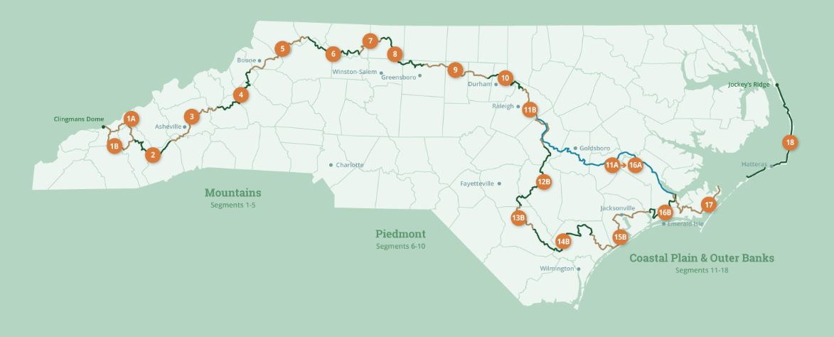
See the Mountains-to-Sea map at the bottom for reference.
I am in the campground shower at 5 AM. No one else in the world of RVs is up. By seven AM - with breakfast completed and a few packing trials initiated with my backpack (so as to be less bulky), I am on the road. Today my focus is on walking the twenty miles to Jacksonville, NC, the home of the Marine Corps at Camp Lejeune and, subsequently, due to no campgrounds near the route, I will reward myself by spending the night in a motel on Marine Boulevard.
Today rain lingers like a shadowy presence throughout the day. All morning as I walk back roads, I listen to distant thunder. Even as I get caught in several brief downpours, the sun, when out between showers, makes the air hot and steamy and soon, I am totally drenched in sweat.


Late morning, I arrive into the outskirts of Jacksonville and after thirteen miles of walking in quietude, the noise of the traffic is discombobulating. It’s the amount of cars and trucks passing the shopping centers on both sides of the four-lane highway, combined with the speed that the vehicles are traveling to avoid stopping at an endless series of traffic lights, which makes walking on the side of the road toward the oncoming traffic (to get to the city’s rails-to-trails path) so dangerous. The mile-and-a-half stretch, though, pays off handsomely with ten miles of Camp Lejeune’s paved greenway around the base and into the city.
A lunch at Burger King turns into a nice reprieve from a twenty minute deluge when the skies finally, fully open up. Eating a burger and fries versus hiking into town with a thirty pound backpack is not an equal comparison on any day but throw in a bucket of rain and I’ll take an Impossible Whopper every time. Cities like Jacksonville, I guess, do have their merits, especially after miles on back roads crossing the middle of no where to get here. Besides, who would have thought when I started the day I’d be eating a Whopper for lunch.


The MST trail takes me through Camp Lejeune Memorial Garden honoring the marines who have fallen in battle. I recognize and find it reassuring - as I sit at the Vietnam Memorial - there is a point to this, to the crazy route the Mountains to Sea Trail asks me to follow. What a somber moment for reflection on things greater than this little hike. So many have paid the ultimate price in service to our country. It’s good to remind myself. It’s good to remember.


I walk by monuments to World War II, Vietnam, Beruit (here nearly 300 marines were killed when two truck bombs exploded outside their barracks) and a steel beam from the World Trade Tower. Even a display on the farmers whose lands were appropriated for the base was fascinating and showed that large scale bases aren’t just created out of the blue, but that six hundred families who lived on small tobacco farms in the area were impacted and their livelihoods changed.
I didn’t think I would find Jacksonville that interesting and wasn’t sure why the MST led us through the city, but as I relaxed in my Days Inn room for the night, I felt like I had received a lesson on what it means to be able to walk across a state. The complaints and pains I am experiencing pale to the privileges I have been given at the sacrifice of others.
Click here to read the next chapter.
Click here to read the previous chapter.
Map of the Mountains-to-Sea Trail. This post focuses on Segment 16b.
The MST lessons abound. The real treasure is that you are open to these lessons. ❤️ M
Thanks Johnathon! Inspiring as I sit here on the Camino hoping the rain will stop and the wind will ease. It is, I suppose, the prayer of all hikers! We are leaving Fonfria this morning...about a week to go.
Blessings
Rich