


A Hiking Companion
MST. Chapter 37. Segment 5 (Part 4)

This is my serialized story of hiking the Mountains-to-Sea Trail (MST), a 1,175-mile route that crosses the state of North Carolina. I’m hiking west from Jockey’s Ridge near Nags Head on the Outer Banks of the Atlantic Ocean to Kuwohi (formerly Clingmans Dome), one of the highest peaks in the Great Smoky Mountains near the Tennessee border. If you’d like to start at the beginning of my story, click here.
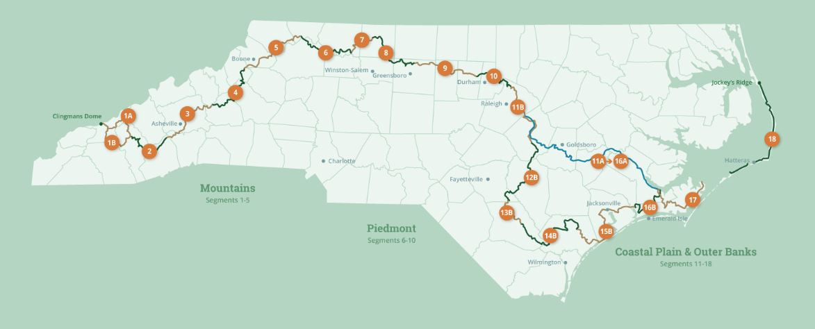
See the Mountains-to-Sea map at the bottom for reference.
Retrieving my car in the middle of a thru-hike is not something I do everyday, but neither is preparing for a hiking companion who will join me for the last day of my four-day adventure. This morning at the hotel in Blowing Rock I arrange for a trail angel to take me to the Raccoon Holler Campground in Glendale Springs where I parked my car to start my hike. Now, the drive up the Blue Ridge Parkway to get to Glendale Springs feels strange—as we quickly pass spots where I had walked over the past two days. I can’t help but recognize how fast we reach turn-ins and overlooks that took me so long and so much effort to get to. Still, forty-five minutes later I am in my car driving back to Blowing Rock and the shopping center I visited the day before. Talk about being discombobulated!
In the shopping center parking lot, I take time at my car to remove items from my backpack that I won’t need for the day ahead—as my companion will drive me to my car later tonight. Still, I realize I can’t be without my tent, air mattress, or sleeping bag in case anything happens, so I resolve to carry them in spite of my urge to leave it all behind. But everything else that I can possibly think of to store in the car—like clothes, my stove, extra food—I put on the backseat floor and that feels wonderful, like I have definitely lightened my load.
Soon, there’s no reason to delay. I lock the car, walk out of the shopping center, and hike back down the freeway a mile-and-a-half to the Mountains-to-Sea Trail. It’s eleven o’clock in the morning when I get to the trailhead, and from the guidelines I know I must now climb four miles up a mountain through the Cone estate to the Cone Manor House. This is the start of a total of ten miles I still have to hike to reach the primitive campsite where I had a permit to camp last night. Then, I must walk another three miles to arrive at the Julian Price Campground, a large operation run by the National Park Service. At Julian Price I have reservations for tonight. If all goes well, at my campsite, I will meet up with Ginger, my hiking partner.
I know Ginger from the exercise gym I go to every morning when I am off the trail. Burn Boot Camp in Durham, suggested by my daughter Helen, offers forty-five minute workouts on a daily basis in cardio conditioning and strength training. For me, this has been a godsend in strengthening my upper body and helping me eliminate plantar fasciitis from my life—both were very much issues I needed to address after walking the five hundred-mile Camino de Santiago in Spain.
Ginger is one of the participants in the gym who, in her late-forties/early fifties, has shown interest in my Mountains-to-Sea adventure and has even hiked sections of the MST with a girlfriend. Now that I am in the mountain section of the MST, she asked if she could join me for a day. I am delighted, of course, as I have seen her level of fitness and couldn’t help but feel that walking with her would push me along on my hike and help me stay focused on what would be my fourth and final day.
Ginger and I plan to meet at around seven p.m., as she works today and it’s about a three hour drive up from Durham. She has agreed to take me to my car so I can bring it to my campsite—as we will need my car for our hike tomorrow. First, though, I hope to treat her to dinner in Blowing Rock. Anyone willing to drive so far to spend a day hiking with me deserves a medal or, at least, to be treated to a good meal!
My goal for the rest of the day, then, is to hike to the Julian Price Campground in time to be ready for Ginger’s arrival. Thirteen miles in these mountains means I’ll be walking for the next six to seven hours. Still, arriving at the campground between five and six p.m. should be more than enough time to set up my tent for the night. Ginger, on the other hand, is not bringing her tent and sleeping bag. She has arranged to stay in a Holiday Inn Express in Blowing Rock.
I am glad to be back on the Mountains-to-Sea Trail—this time hiking up a meandering mountain lane through the Cone’s 3,500-acre estate. By mid-day I arrive at the Cone Manor House, a twenty-room mansion built in 1901 by Moses Cone, a leading North Carolina industrialist during the Gilded Age. The house now is an impressively restored structure maintained by the National Park Service. I enjoy a brief respite eating a protein bar while sitting in a wicker chair on the veranda. A number of tourists who drove up the mountain to tour the house sit on either side me. Somehow, with my backpack at my feet and my protein bar in hand (versus a glass of chablis), I appear to be the odd man out.


Soon I am up and on one of the 25 miles of carriage trails around the estate. I am following the white blazes of the MST down the backside of the mountain. Then, I am directed to hike up Rich Mountain while still on the meandering lane. Four miles later, quite abruptly my downward trek begins—starting with crossing over a wooden stair-step stile over a barbed-wire fence. So much for the pleasant carriage lane—this section consists of a steep series of switchbacks enclosed within a thick forest of pine. I take it slow as on similar trails I have been known to get caught up in tree roots and fall headfirst into the thicket in front of me.
I reach the bottom of the mountain without incident and two miles later pass the site of the primitive campground I had reserved for the previous night. After having hiked the ten miles to this location, I stop and take another break. I thank my lucky stars I stayed in Blowing Rock. I can’t imagine how I could have found this spot so late in the day/night yesterday. The realization of what that might have meant—had I tried to make it—washes over me and speaks to the importance of listening to my gut. I am so thankful I stayed in Blowing Rock and took the time early this morning to get my car as opposed to still having to do it once I finish my hike later this afternoon.
The next three miles to the Julian Price Campground, it turns out, are incredibly difficult. My pace slows considerably as I choose my steps in climbing up over the rocks along the Boone Fork Trail—a trail the MST shares as it enters into Grandfather Mountain State Park. Tomorrow Ginger and I will be hiking a similar trail, the Tanawha Trail, for thirteen miles, also as part of the MST.


The Boone Fork Trail is the perfect example of what I didn’t expect—in my mind’s eye, reading the directions, I thought it would be so much easier. However, as tough as the footing is, the landscape around the trail it is beautiful. I only wish I had time to explore the area more thoroughly. As a thru-hiker, my energy is limited and even the idea of returning tomorrow with Ginger is somewhat negated due to the additional miles of Segment Five we hope to hike. This is one more spot in a series of spots across the State I promise myself I’ll return to.


Reaching the Julian Price Campground is a welcome relief, even though the size of the campground is so large that it takes me twenty minutes to find my campsite. As dusk approaches and I set up my tent, I can hear thunder in the distance. I pray that it doesn’t start raining this evening—the one thing I gambled on and left in my car is the rain tarp I typically carry to cover my tent.
I am surprised to discover I have no cell phone service. It dawns on me that from here I wouldn’t have been able to arrange for anyone to pick me up and drive me to my car in Glendale Springs. Handling the logistics this morning at the hotel, it turns out, was the only way to get my car without significantly imposing on Ginger. Thank goodness I brought my car to Blowing Rock this morning.
An email message sent earlier from Ginger says she will be a half-an-hour late due to some unexpected car troubles. I am sitting at a picnic table somewhat frustrated that I can’t write back when I realize I can use my Garmin InReach GPS unit—the one I have been carrying on my backpack for the past several segments. I get the unit from my pack and send a message—via satellite—to my wife Karen, asking her to contact Ginger. Karen acknowledges my message—via satellite—and I breathe a lot easier.
Still, I wonder, in hiking the next four segments of the MST, if I’ll ever have cell phone service again. The four hundred dollars I spent on the Garmin InReach GPS unit seems like it has been a smart purchase after all and, most significantly, my only way, perhaps, to communicate going forward.
At seven-thirty Ginger pulls into the Campground and I’m waiting for her. I jump into her Ford Mustang and it’s great to see her outside the gym! We drive back to Blowing Rock where I treat her to dinner. The restaurant is crowded, but we sit at the bar and, as we eat, we pour over the MST guidelines for Segment Five and finalize our plans for tomorrow. Before leaving the restaurant, I call Karen. It’s good to hear her voice and I promise to be mindful tomorrow that I am hiking with a partner. A short while later Ginger drops me off at my car and departs for the Holiday Inn Express. We agree to meet at the campground at six-thirty a.m.


The next morning Ginger arrives on time and is carrying two cups of coffee. She says they’re courtesy of the hotel and hands me one for breakfast. I’ve already taken down my tent and packed up my backpack, so drinking a cup of coffee is perfect. In my car I have a day pack set up precisely for this hike and it, too, is ready to go. I am especially thrilled to leave my larger, 65-Liter backpack in my car.
We park Ginger’s car in the parking area overlooking Price Lake next to the Julian Price Campground and drive my car up the Parkway to the road beside the Beacon Heights overlook. This is where the MST Trailhead is for day hikers and where Segment Five of the MST ends. A number of cars are parked along the road, so I find a spot and park my car as well. From here we will walk back to Ginger’s car thirteen miles away. In short order we are on the trail, happy, and enjoying the hike.
It’s strange heading “east,” rather than “west,” as “west” has been my focus for so long on hiking the Mountains-to-Sea Trail. But this isn’t the first time I’ve had to make that compromise. In the Holly Shelter Game Lands when I was near the coast, a trail angel took me north of the protected state lands and I walked back twenty miles to get to my car parked just outside of Surf City. So, too, due to the help of trail angels, I walked in the opposite direction on one part of Segment Twelve—and in both instances I was tremendously grateful for the help the trail angels provided.
On the Tanawha Trail large boulders are somewhat of an impediment, but are not nearly as confined into one small area as yesterday’s hike on the Boone Fork Trail. We follow the trail past the closed Lin Cove Visitors Center and are soon under the Viaduct—with the Parkway over us. The viaduct, the last section of the Blue Ridge Parkway constructed, opened twenty years after the rest of the scenic highway.
Ginger is using hiking poles for the first time. I had warned her that hiking poles were critical on these trails and am pleased that she brought hers and is actively working with them as we follow the white blazes of the MST up and over the various ridges.


The Tanawha Trail from Beacon Heights is a challenging thirteen-mile stretch with some incredible vistas of Grandfather Mountain as well as the surrounding mountains in the distance. I enjoy Ginger’s company and am relieved to discover we both hike at the same pace. It is the first time I have walked the Mountains-to-Sea Trail with a partner and the rhythm we get into is an easy one with limited conversation and lots of stops to observe and take picture of the flora and geological features of the region.


When we finally reach Price Lake next to the Julian Price Campground, we are well into the afternoon. By three, though, we drive Ginger’s Mustang to the tiny town of Linville to celebrate our hike together and, for me, for completing Segment Five of the MST. We stop at a bakery—the only place open that serves food—and order cake and coffee. Then, I realize the bakery also offers Hershey’s Ice Cream! I order two scoops of Banana Pudding ice cream and am in heaven.
After our short celebration Ginger drops me off at my car before heading home. I suggest she accompany me to hike Segment Four—a seventy-seven mile stretch through the 500,000 acre Pisgah National Forest. Unfortunately, she tells me, she has to work and can’t take off as many days as we would need. As enjoyable as hiking with Ginger has been, I guess, once again I am on my own—this time for a five-day/four night adventure crossing uninterrupted through the Pisgah Forest.
As I drive back to Durham, I’m a little nervous about what lies ahead. In my call last night, Karen said they’re forecasting rain every day—plus, she emphasized, there’s a hurricane in the Gulf heading for Florida’s coast. In fact, once it makes landfall, it’s projected to shoot up through Georgia and Western Carolina. In hiking on my own in the Pisgah Forest, that doesn’t sound good. Not good at all.
Click here to read the next post.
Click here to read the previous post.
Map of the Mountains-to-Sea Trail. This post focuses on Segment 5.
Thanks for adding me to the list to receive your 'blog.' I'm really enjoying your story! However, I'm very concerned about your doing the remainder of your trip, given the devastation from the hurricane this week. Please let us all know what is possible, and what you decide. (Carmen Ward)
Oh dang! I hope you weren't out there during the hurricane! I had to cancel my thru hike of the Bartram Trail because of it. I heard Western NC was really bad!