


Along the BRP
MST. Chapter 36. Segment 5 (Part 3)

This is my serialized story of hiking the Mountains-to-Sea Trail (MST), a 1,175-mile route that crosses the state of North Carolina. I’m hiking west from Jockey’s Ridge near Nags Head on the Outer Banks of the Atlantic Ocean to Kuwohi (formerly Clingmans Dome) near the Tennessee border in the Great Smoky Mountains. If you’d like to start at the beginning of my story, click here.
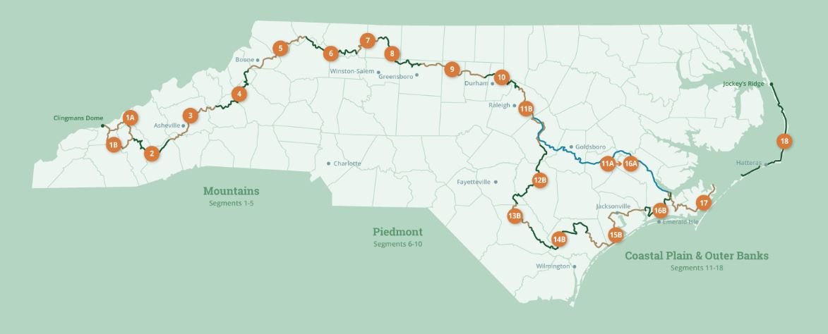
See the Mountains-to-Sea map at the bottom for reference.
At Raccoon Holler I make my reservations. Raccoon Holler is a private campground just outside of Glendale Springs. Yes, I am back in Glendale Springs to continue my hike on the Mountains-to-Sea trail as this is where I left off earlier to visit an old friend. Calling Raccoon Holler, I have been told to register before four p.m., which I can do, but first I must drive to the Rangers Station at the Doughton Recreation Area to obtain two primitive camping permits. My plan, upon hiking out of Raccoon Holler, is to camp at two of the four remote sites offered by National Park Service near the Blue Ridge Parkway between Glendale Springs and the large Julian Price Campground on the other side of Blowing Rock. My goal with this four-day thru-hike is to make it to Beacon Heights, twelve miles past the Julian Price Campground. This will complete Segment Five of the Mountains-to-Sea Trail and set me up for Segment Four. With my permits in hand and now registered for overnight camping at Raccoon Holler (with twenty minutes to spare), I am good to go for tomorrow morning.
So I drive off to the local diner in Glendale Springs that the campground manager says everyone goes to. The next place, if I want something different, is like thirty miles away. When I go inside the diner, a sign on the wall announces that service may take awhile as there is only one cook and one waitress on staff. Hmmmm…Luckily, at this time in the afternoon, I am the first to arrive for dinner. I peak through the service window to see if this is the waitress’s day off, but she is at the sink washing dishes. I say hello, sit down at a table, and wait my turn. Barbecue with french fries and corn leaves a lot to be desired, but it’s filling. After dinner I go back to Raccoon Holler and am soon plagued by a security night light that shines into my tent all night.
Waking up early the next morning, I pack up an backpack, and park my car near the office (with permission). With my pack on my back and my hiking sticks in hand, I walk the mile-and-a-half to the spot on the MST just outside of town where I had stopped earlier. My goal is to hike twenty-one miles on the Trail, so this extra distance from the campground will make my day that much longer. I am carrying dehydrated meals and protein bars and know my wife Karen and daughter Helen will not be pleased that I haven’t made provision for any mid-day meals. However, I figure bears won’t be attracted to my food bag with nothing in it but dehydrated meals and cellophane-wrapped protein bars. I mean, there’s no smell to smell.
Two miles into my hike on the MST I reach the Jumpingoff Rock Overlook, the first of numerous overlooks along the Blue Ridge Parkway that I expect to encounter throughout the day. The views are impressive but I can’t linger if I am going to reach my goal of twenty-one trail miles. Hiking roads in the Piedmont this would have been a long day, but not undoable. Here, in the mountains, I am still judging how far I can walk in a day before dusk changes everything. Going twenty-one miles seems ambitious, but won’t be as bad as tomorrow when I plan to hike twenty-four miles.


It’s a quiet morning and I am moving pretty well on a trail that seems to be tethered to the Blue Ridge Parkway. With sections of the road closed for repair to “drive through” traffic, I only hear the coming and going of locals who live off the Parkway. Some of their houses are spectacular and others are just shacks in the woods. With such a wide spread of economic status, it would be hard to say what came first—the locals or the Blue Ridge Parkway. For most, though, with construction of the Parkway begun in 1935 during the Depression, I would suspect it was the Parkway that brought them here. That said, the Parkway wasn’t completed until 1968, and this doesn’t include the eight-mile section in Grandfather Mountain State Park which wasn’t finished until twenty years later.


Near the Mount Jefferson Overlook, the guidelines have hikers cross over a stile and into a pasture. The cows lounging under a grove of trees at the top of the hill stare at me as I walk past. They seem to know I am no threat. The Mount Jefferson Overlook provides a spectacular view of the mountains off on the horizon—wouldn’t it be glorious to get such views everyday. Shortly thereafter, as I come off the mountainside, I find a running stream and refill one of my water bottles. This comes with the realization as I drink from the other bottle I am carrying, that I need to continually replenish my bottles as I hike along the Trail.
I reach Benge Gap in the late morning about eleven miles on my way. The directions indicate a restaurant/cafe is off to the right, but when I reach it, workers on a small gift shop next door, tell me that the restaurant is closed until Friday. If I want to wait, I’ll have to remain here for two days. That’s a long time when I don’t even see a menu in the front window. Still, with no one around in the restaurant, I decide to sit in the outside seating area. With my backpack stove I make a bowl of hot oatmeal and a cup of instant coffee while I filter the water from the stream in my one bottle.
I actually spend more time in the outdoor seating area than I expect—though the break is really nice. But, by one o’clock in the afternoon I am back on the trail heading for the Cascades Recreation Area with its promise of bathrooms. For me, bathroom sinks are a great source of water. I look forward to getting my two water bottles refilled before I begin the hike to the primitive campsite I reserved—I have been told by the ranger at Doughton there is no water at this location.
Four miles later and fifteen miles into my hike I reach the Cascades Recreation Area and am thankful it has actual bathrooms—not port-o-johns—and that they are open. It’s a good mid-afternoon stop, though whatever view of the mountains that was once here at this turn-in is now obscured by a thick canopy of trees. Still, getting my bottles refilled is a godsend. I call Karen and Helen, as I am not sure I will have cell phone reception when I get to my campsite location. They are surprised to hear from me and, I must admit, it’s nice hearing their voices.
It’s three-thirty in the afternoon by the time I am back on the trail. With six miles to go, I recognize, given my pace here in the mountains, I have at least three hours of hiking before I get to the campsite.
Four-and-a-half miles later I cross over Highway 421 on the Blue Ridge Parkway. This is exciting as the bridge was closed for over a year while the expanse was renovated. I couldn’t imagine how hikers walked around this construction and am glad the bridge is now reopened.


Two miles later I am at the primitive campsite for the night. Known as Deep Gap, I expect the site to be at the bottom of a mountain, but rather, it is at the top. I have perfect cell phone reception. It’s nearly seven pm and I am the only one here. I like how nice the campsite is with its little fire pit and two other tent clearings for additional campers. I don’t build a fire but do take the necessary precautions when using my stove to make dinner away from my tent. The rehydrated meal is more hot than good but, nonetheless, offers plenty to eat. I call Karen and she is glad to hear from me. She tells me to watch out for bears. The night passes uneventfully except for the incredibly loud sounds of thousands of crickets mating.
The next morning I am up with the sunrise, once again, and soon packed and on my way. Though I had walked a total of twenty-three miles yesterday, I recognize that walking twenty-four miles today—in order to reach the primitive campsite I reserved at the ranger station at Doughton—will be a lot harder to achieve. I could be hiking for twelve hours straight—not a pleasant thought. Fortunately, within the first few miles I reach another running stream and fill up my one empty bottle depleted from dinner and camping the night before. After purifying the water in the bottle, I am back to having two full bottles of water for the day—if not the morning.
Today’s hike—though it weaves in and out along the Blue Ridge Parkway—is more confusing and on several occasions due to a sudden dearth of white blazes, I am lost or would be if I didn’t turn on MST app on my cell to see where I am in relation to the trail. Finally, when I get to the Grandview Overlook, I am reassured all is good and I am still on the trail. I take a moment to appreciate the stunning view.


Bamboo Gap leads to Boone’s Trace, where I eat lunch sitting on an old picnic table while some man is fast asleep in his truck at the turnoff. I don’t want to deal with him if he wakes up and soon leave. This leads me to the Goshin Creek Viaduct and a beautiful hike up the mountainside over massive boulders alongside Goshin Creek. Again, I refill both of my water bottles—this time from the fast flowing creek. I stay long enough to treat both bottles and with the heat of the afternoon upon me, I start drinking from them less than an hour later.


Once past the Goshin Creek reserve I am directed over several stiles and walk the next few miles in pasture. The cows are curious, but move out of my way so I can work my way past. I am sure they must think I am crazy and, in truth, hiking in a pasture full of grass tuffs and large black patties of manure, while avoiding downed trees—with the paved Parkway just fifty feet away—seems a little crazy.
I reach a large tree that has fallen and appears to separate the pasture in half and stop for an late-afternoon break. It’s nice to have a temporary reprieve from the thirty-pound weight of my pack. Today, I realize, I have taken many more breaks than the day before, and, on top of that, my pace has slowed. This is not a good sign if I hope to walk further than I did yesterday. Soon I force myself to start moving again.
When I reach Raven Rocks Overlook, I meet a motorcyclist who says he is thinking about riding his bike (with a small wagon attached) across the United States. His name is Bobby and he says he’s been coming to this overlook all of his life. He shows me his favorite rock just off the trail and says that he finds it a perfect location to smoke weed. He offers me a toke but I turn him down. I have too far to go today and can’t afford to get disoriented once again.
Bobby actually reminds me of a high school friend who passed away four years ago. Back in school Bruce and I were pretty close—running in the same small group of friends. As I say goodbye to Bobby and continue on the MST, my thoughts turn to Bruce and how our lives turned out so differently. All is good, I suppose, but we definitely went on different paths. I regret now not going out of my way to see him when I returned to visit family in my old hometown. Now, he’s dead. Died of cancer. I went to his funeral, but I felt like an outsider, an intruder—pretty much a lousy after-the-fact friend knowing he was fighting cancer. I should have done more to be supportive and, really, to keep our relationship going when, in truth, getting together would have been such a normal thing to do.
Such thoughts of lost friends are easy to dwell on when walking alone. Who would have thought this would come up out-of-the-blue. I am really not a good person.
Shortly after five in the afternoon, I arrive at a spot that puts me within a mile of the tourist town of Blowing Rock. Though the directions I carry do not say anything about the distance to the nearest accommodations, I realize, with about ten miles to go to reach my primitive campsite, getting to that site before dark will be impossible.
I decide, rather, to go into Blowing Rock. It isn’t hard to stop at the first convenience store on the highway into town and buy a bag of potato chips, a Snickers bar, and an orange soda. Outside, behind the store, sitting on a retaining wall, I plan what I should do next as my only reservation for the night is at a primitive campground.
A shopping center is nearby so I walk to it but find no grocery store or restaurant. I stop at a bench and begin searching my phone for a motel. Luckily I find a hotel about a half-mile away. Though the manager says it’s closed for renovations, he takes pity on me and lets me stay in one of the finished rooms. I am the only one at the hotel and couldn’t be happier. I take a long shower and later, rather than going out to dinner, I get my stove from my pack and rehydrate another meal I have been carrying. I go to bed knowing I should be ten miles further on the trail, but I am grateful for this luxury.


The question becomes, how can I make this stay in Blowing Rock work to my advantage. In two days I have a friend from my gym back in Durham joining me for the day. Ginger has followed along as I hiked across North Carolina and even taken on parts of the Mountains-to-Sea Trail with a girlfriend herself. She asked if she could hike with me. I am thrilled. This will be the first time I have hiked with a partner.
To prepare for Ginger’s arrival, I decide to contact a trail angel to drive me back to Glendale Springs tomorrow so I can get my car. My plan, finalized in the room, is to drive my car to Blowing Rock and park it in the shopping center I just visited. After I get my car situated, I’ll hike the rest of the day—six hours total—to the Julian Price Campground thirteen miles away. I text Ginger to pick me up there, so she can drive me to my car in Blowing Rock. My plan is to drive it back to the campground as we’ll need both of our cars for our hike.
It’s amazing how much logistics is involved in hiking the Mountains-to-Sea Trail. I am not surprised at this point actually, but recognize, once again, it’s not simply following white blazes on trees. That night, I don’t sleep very well—anxious to get started tomorrow—and finally get up around four in the morning. I take the extra time to go through all my gear and decide right then and there what I need to carry, what I can leave in the car once I have access to it, and what I can throw away. At the primitive campsite, if you pack it in, you have to pack it out. But here, lightening my load using a hotel bathroom trash can is a cathartic experience.
Click here to read the next post.
Click here to read the previous post.
Map of the Mountains-to-Sea Trail: This post focuses on Segment Five.
Jonathan,
Your reflections of Bruce, your childhood friend, seemed to invoke self doubt. Never doubt the amazing person you are! Friends are often like seasons they come and go and provide opportunities for us to grow on this spectacular journey called life. Keep hiking to find the true serenity you are seeking. ❤️ Marlene
Ugghhh, logistics! I'm getting a headache over that with my upcoming little thru hike next week!