


New Glasses, Downed Trees...
MST. Chapter 27. Segment 8

This is my serialized story of hiking the Mountains-to-Sea Trail (MST), a 1,175-mile route that crosses the state of North Carolina. I’m hiking west from Jockey’s Ridge near Nags Head on the Outer Banks of the Atlantic Ocean to Kuwohi (formerly Clingmans Dome) near the Tennessee border in the Great Smoky Mountains. If you’d like to start at the beginning of my story, click here.
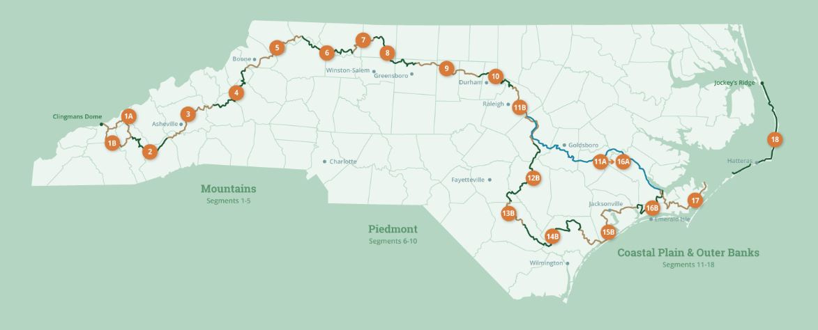
See the Mountains-to-Sea map at the bottom for reference.
The weather for the next few days will be beautiful. I am psyched to get started on Segment Eight, my next segment of the Mountains-to-Sea Trail. First, though, my wife Karen, daughter Helen, and I go out for lunch the Sunday before my adventure begins. How pleasant it is to simply sit at a winery on a lovely May day, enjoy the ordered rows of grape vines in the distance, and walk no further than to and from the car.
Two days later Karen drives me an hour west of our house to the Bryan Soccer Complex above Greensboro. This is the spot where Segment Nine of the MST ended and where Eight begins. It’s nine-thirty in the morning and in the car before I get out Karen runs down, for the fourth time, everything I should have in my backpack, things that, on one thru-hike or another, I have forgotten, such as the cord to charge my cell phone from the charger I carry, enough water to get through the stretches of the hike where the distances between sources are significant, and bear spray—yes, that one all important canister she wants me to carry now that I am entering a more forested world. Segment Eight is still part of the Piedmont section of my hike, but as I walk further and further west, the likelihood of encountering a bear sooner or later she believes, is inevitable. I remind her that there are more bears in eastern North Carolina than in the west, but none-the-less, the bear canister is now strapped to my side.
I have planned a four-day hike which should allow me to complete Segment Eight, a segment that will have me work my way around Greensboro’s man-made lakes/reservoirs before being back on country roads. The goal is to reach Hanging Rock State Park in three days. Hanging Rock is the first of the Sauratown Mountains—a range separate from the Smokies—and the end of this segment. My hope is that on my fourth and final day I’ll be able to hike over Hanging Rock and around Sauratown Mountain to arrive at the base of Pilot Mountain where Karen will pick me up.


I love getting started. The excitement of what’s to come is intoxicating. I have twenty-three miles to hike today to reach my first destination—a camping site in the town of Oak Ridge, so I am anxious to get going and determined to have a great day. If all goes well, I should be at my camp site between four and five this afternoon.
Only, once I say goodbye to Karen and hike out of the parking lot and alongside the many soccer fields in Bryan Park, I realize I am totally lost and have no idea where the trail is (as described in the printed directions I am carrying). A quick powering up of the GPS feature on the FarOut app on my phone, which highlights the Mountains-to-Sea Trail, shows me immediately where I went wrong, and so I reverse course and, soon thereafter, am on the correct trail hiking into the woods.
I am wearing new glasses for the first time. Typically, I carry reading glasses in my pocket for following the directions. Having grown up with 20:20 vision, my eyesight hasn’t been a problem. Now though, I am told that my new transition glasses will allow me to see distances more clearly as well as read things up close. Unfortunately, in the woods where distances are not an issue, I discover the bifocal portion of the glasses are distorting my ability to determine accurately where I am stepping. After stumbling around trying to avoid tree roots and rocks, I give up and pocket my new glasses for my own safety. Who knew the woods could be so dangerous?


A total of fourteen miles of trail along the southern shores of Lake Townsend and Lake Bryant are more than I expect, and it isn’t long before I realize that I should have studied the MST trail map more closely. The significance of this is that hiking in woods is more time-consuming than hiking roads, and now I am way off the pace of what I had hoped to walk each hour. Still the day is beautiful, and I take a lot of pictures, including the dam releasing gushing water into Lake Townsend.
By two-thirty in the afternoon, I am five hours into my hike, but I have only covered eleven miles. I still have twelve more miles to go. Rather than walking just under four miles an hour, as I have been able to do on roads, I am averaging closer to two miles an hour. I recognize, as a result, I better pick up my pace, or I’ll be hiking tonight in the dark. Unfortunately, shortly thereafter, things fall apart.
On the trail around Lake Townsend I reach a large Loblolly pine tree that has crashed across the path. It is lying as high as my waist and takes awhile for me to navigate over it with my backpack, hiking sticks and cell phone (which I have pulled from my back pocket). Soon I discover that this tree is a precursor to many downed trees in this area. I don’t know what happened or when—whether a small tornado or water spout has hit this location—but the area has exploded with down trees everywhere.
The route ahead looks totally impassable. I can’t help but think I should have checked the MST website for a trail update before leaving home (which I didn’t bother to do—big mistake!), as I could have printed off updated directions, which would have shown me how to get around this calamity. I remember the FarOut app on my phone and power up the GPS for an alternative path, but it too indicates no change. My route, it shows me, is straight ahead.


So the intrepid warrior that I am, I start climbing over downed trees as high as my chest and pushing my way through branches heavy with pine needles and leaves. In scampering over the trees, I search for poisonous snakes and Brown Spiders, which I recall from some horrible place in the back of my mind, are known as Reapers due to their poisonous bite. Though I don’t have gloves, I sweep off hundreds of tiny spiders who seem just as happy to get away from me as I of them before I climb the trees.
At one point, I am completely hemmed in and can’t go forward or backward and the idea of pushing my way under the tree in front of me seems like a welcome sign for anything poisonous to hop on and eat me, but after searching around I find a small jutting branch and pray it doesn’t break in holding my weight as I shimmy my way on top of the long bole. Rising into a crouch position, my focus is on staying balanced, what with a twenty-pound pack on my back, hiking poles in one hand and my cell phone in the other, as I gorilla-walk the length of the trunk. One serious fall at my age—hell, at any age—and I would be totally fucked. At the other end of the tree near the overwhelming swirl of clogged branches, I find an opening and slowly shimmy myself down, but not before seeing with my new glasses the trail in the distance. Back on the ground clustered with downed trees, I forge ahead with the idea of reaching the trail as my only goal.
An hour later I am through the damaged area. I spent an hour-and-a-half going three hundred or so yards. Amazing.
By four-thirty I am finally out of the forest and in the small town of Summerfield where I stop at a cafe, the Jumping Bean, and order two large cups of Americano coffee at the drive-in window. Even if I have miles to go to reach my destination, I need a moment to celebrate being alive in civilization. I sit at a table outside the small shop and rest. Studying my printed directions, I calculate I still have eight miles to hike. Still, it’s walking roads ahead and I can pick up my pace substantially.


I am joined at the table by a gentleman who saw my backpack beside me and introduces himself as Harry. He is the proprietor of the coffee shop and has a goal this year of hiking ten miles every week. Soon we are discussing not only the Mountains-to-Sea Trail, equipment and camping, but all the other trails in the area. As I stand to leave, he points out a bathroom in a nearby building, which is wonderful—if only to wash my face and check my hair for lingering spiders. Soon I am back on my way with a strong handshake and a new friendship courtesy of the Mountains-to-Sea Trail.
I reach Oak Ridge by six-thirty in the evening, but it takes me until seven to get to my campsite. Oak Ridge is known for its military academy founded, I read from a road sign, back in 1852. Many of its students fought for the South during the Civil War and, later, its students and alumni served in World War I and II. Oak Ridge still operates as a military academy, but when I walk past the buildings on the campus, I realize most of the students are away on vacation as the place is empty.
I find my tent site in the town’s athletic park. It is the only tent site offered to MST hikers. In the distance kids are playing organized soccer and baseball with many parents watching. From the cheering coming from that end of the athletic field, a game of one or the other must be being played. Near my location, which is behind the tool shed, I can see several families holding a cookout in a large pavilion nearby. A playground full of young kids is even closer.
The bathrooms are in a small building between me and the pavilion—unfortunately, the spigots in the sinks shut off every fifteen seconds. If that isn’t bad enough, I discover the sinks are too small for my water bottles, and, wouldn’t you know it, I have forgotten to pack a cup. So, in frustration, I get a plastic sandwich bag from my back pack, which held tablets of ibuprofen, empty the pills into another bag, and use the sandwich bag to transfer water from the sink to my bottles. Who would have thought, given everything else I encountered earlier today, I would need homespun ingenuity to fill up my water bottles. There will be a day, I swear, when I remember to carry everything I need.
Lying in my tent with my new glasses on and eating two peanut butter and jelly burritos for dinner, I check the Mountains-to-Sea Trail website for updates (using my cell phone) and realize that the website has no mention about the micro-tornado/blow down that I encountered on the trail at Townsend Lake. I write to the staff, as directed, about my nearly disastrous situation and hope the accompanying pictures go through.
Even though I made it over the downed trees safely, I consider it impassable for most people. Only crazy thru-hikers like myself, I supposed, would gut it out. To be clear, this is not good. I recognize that what I did could have led to a really bad situation. This is something I must consider about myself, who I am and what I am willing to do when I encounter such difficulties or obstructions—if I find something like this in the future, I need to believe I will listen to an inner voice—maybe a voice that sounds much like my wife’s— and be willing to back off and find another way.
That night at around ten o’clock high school boys pull into the park and take over the playground near me. They are loud and joke around about girls and homophobia and I wonder if I joked in such a loud, stupid manner when I was their age. They have so much to learn about themselves and the world. By midnight they, too, are gone and I finally fall asleep. The first day of another one of my MST journeys has been full of twists and turns and lessons I have discovered and, hopefully, learned.
Click here to read the next chapter.
Click here to read the previous chapter.
Map of the Mountains-to-Sea Trail. This post focuses on Segment 8.
Yikes! You are a pioneer; helping to keep the trail clear for those who come after. Are Reapers the spiders also known as Brown Recluse? That alone would deter me. Also, have you thought about carrying one of those water filter things that makes it safe to drink from the Dan or any other body of water like mud holes, swimming pools, sketchy creeks, etc? Karen would, I’m sure, like you to carry it along side the bear spray.
We don't call you the Camino Beast for nothing! I suspect your inner voice will not be altered by mishaps on the trail. Trust you and most importantly trust God! ❤️ M