


The Haunting of Harmony Hall
MST. Chapter 21. Segment 13

This is my serialized story of hiking the Mountains-to-Sea Trail (MST), a 1,175-mile route that crosses the state of North Carolina. I’m hiking west from Jockey’s Ridge near Nags Head on the Outer Banks of the Atlantic Ocean to Kuwohi (formerly Clingmans Dome) near the Tennessee border in the Great Smoky Mountains. If you’d like to start at the beginning of my story, click here.
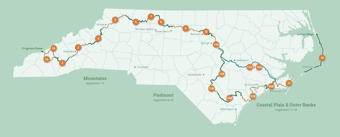
See the Mountains-to-Sea map at the bottom for reference.
I wake up, check my watch, then go back to sleep. For most of the night the storm has raged outside my White Lake motel room—its ferocity at times surprising. Fortunately, the rain stops in the early morning hours. I wake up an hour or so later and decide to take it easy this morning. Give the world a chance to dry out.
This is my last stay in a motel on my five days of hiking this segment of the Mountains-to-Sea Trail and I want to take full advantage of it. The room comes complete with a microwave oven, so this morning I enjoy a cup of instant coffee in my styrofoam cup while lying in bed. Then, I decide to take another shower, even though I showered the night before. I thoroughly enjoy the second deep soaking. In fact, this is as good as it gets as I can’t be sure when my next shower will be—maybe two days from now when I hope to be at a campground with a wash house.
In looking at my MST directions printed off earlier, I have only twenty-one miles to hike today to make it to Harmony Hall, an old plantation on which I have been given permission to camp for the night. After two days of walking twenty miles by noon, taking it slow all the way to Harmony Hall will be just fine.
As I pack up and prepare for the hike ahead, I worry about four things: butane fuel—I have been using it with my camp stove more than I expected and can’t be sure I have enough for the remainder of my trip, ibuprofen—I already have gone through most of the pills in my plastic travel bottle, trail mix—I’ve eaten everything I brought with me, and batteries—I rely totally on my headlamp and can’t afford to have it die out over the next several nights. The thought occurs to me, too, that an extra sweater or travel blanket could be nice, might even help me stay warm...
The directions indicate, in fact, I’ll pass a gas station/convenience store and a Dollar General Store within the first three miles of today’s hike. These two stores will have to do as I see no other places to get supplies the rest of the way to Harmony Hall.
I walk out of the motel to a sunny morning. The sky is clear but the wind is up. This is kite flying weather and the gusts are formidable. I am hiking along Route 701 heading West out of White Lake and am surprised with the number of logging trucks and trucks I can smell almost before they arrive—trucks full of crates for pigs and chicken—that rush past me. A half-an-hour into the walk I come up on the convenience store at the intersection with Route 53, which runs South toward Kelly. I am happy to have hiked that section of the highway already, coming up from Kelly, and have no interest in repeating such a desolate trek. I stop at the convenience store, though, both to shop for my needs and to see what it offers for breakfast.
Strolling around with my thirty-pound pack on my back, I enjoy a cup of coffee and pick up two bananas, two breakfast bars (minimum sugar, maximum protein), and, most critically, a travel vial of Advil. With the ibuprofen in hand, I am good to go. My water bottles are both full, and I have no desire to carry more, even though I am camping tonight at a place that has no potable water—no water safe to drink.
At the counter, the clerk asks a thousand questions regarding my trek, where I’ve come from and how far I still need to go. She says she’s never heard of Harmony Hall but is really envious of what I am doing. After we talk for awhile, I pull out my credit card to pay, but she tells me to put it away. She says that she would be honored to pick up my purchases in support of my journey. I am shocked by her gesture and, in truth, the benevolence of strangers I’ve encountered on this hike has been amazing. It can’t always be like this, can it?
She asks if she can take a selfie with me and comes around the counter. She calls for two other employees to join us and presently I am sandwiched among the three of them for a photo she says she’ll put on their bulletin board. They are full of chatter about taking on such a hike and needing to get into shape, but they could “never in a million years” do this. I wonder, in truth, if I can either, if I can see this hike all the way through—but their energy is infectious. As I leave, they all wish me the best of luck in reaching the vaunted Great Smoky Mountains.


A mile later, the Dollar General store proves to be an equally good stop, and I am able to purchase extra batteries for my headlamp and a large can of mixed nuts—the contents of which I immediately transfer into an extra plastic bag I have and tuck into my backpack. Though I find Long Johns for sale (which I already wear at night), I see no sweaters or blankets to serve my needs. With this final decision, the clothing and sleeping accommodations I am carrying will have to do for the night ahead.
I am a little nervous about sleeping in my tent in this weather. With last night’s storm, a cold front is now passing into the area and the temperature is dropping. I haven’t camped since June when I finally walked out of the Croatan National Forest. Since then, I have either been the guest of trail angels or sleeping in timely, cheap motels. In fact, I have not camped in winter since my twenties when a good friend and I traveled across America, departing from our hometown in Pennsylvania in early January.
My friend and I camped out of our vehicle in numerous state and national parks, and I brought a sleeping bag for the trip that proved perfect for cold weather. But due to its weight and bulk, I never liked carrying it with a backpack. For the Mountains-to-Sea Trail, I chose instead to take my double-puffy blanket with enough down in it to keep me warm this past spring and summer. Most importantly, it can compress into a tight, one-pound sack that slides easily into my backpack.
However, now in cold weather, I am not sure how my puffy blanket will perform. Still, between my Long Johns and my sleeping bag liner, along with my old hoodie sweater, heavy socks, and my winter jacket, I gamble I will be fine—or, at least, I hope so.
Either I have guessed correctly or I will freeze to death.
First though, I have a long walk ahead and, between the late start with two stops to shop, I am staring at a day that’s already mid-morning with eighteen miles to go.
Before long, I turn off of the highway and hike five miles on a little used road to the Turnbull Experimental Forest. Entering at the forest gate, I am glad after two days to be finally off of hard road surfaces. My enthusiasm for hiking the dirt road, though, quickly takes me off the Mountains-to-Sea Trail, and it isn’t until approximately a half-a-mile later that I realize (through checking the trail app on my phone) that I have left the MST route behind. This is a mistake and learning experience—one can walk the roads comfortably and be assured he or she is still on course, but in the forests, things change rapidly and frequently consulting the app is key to staying on point.
Walking back almost to the entrance, I see where I should have taken a little trail to the right. This makes me nervous as the path seems to have been barely cut out of the forest. White blazes on the trees, though, are reassuring that I am on the route correctly. When it dips down into a swamp forest, or pocosin, I wonder, again, if this where I am supposed to go, but I forge ahead picking my way gingerly around countless water bogs and placing broken logs over knee-deep streams to cross without getting my feet wet. In the spring or summer, I would be worried about snakes, such as water moccasins, or even ticks, given the bushes I am walking through, but today its only pooling water from yesterday’s storm that’s the issue. By the trail’s end, one of my shoes is totally soaked and the other not much better.


The trail leads me out of the forest and onto a highway with the entrance to Jones Lake State Park on the other side of the road. Crossing over to the Visitors Center, I take time to eat lunch (my new bag of mixed nuts and a breakfast bar), change my socks, and refill my water bottles (this is the last stop before tonight).
Jones Lake is an interesting park as during the long period of segregation in North Carolina, it was designated for Blacks only. This led to many years of neglect by the State, but now new facilities and a pristine forest around the lake makes this an attractive location for all visitors alike, including backpackers who can camp here—though I decided in my planning my trip this would be too early in the day to stop.


The MST trail at Jones Lake leads me into the Bladen State Forest, and it isn’t until five miles later that I am back on hard road surfaces again. A final four-mile stretch in the late afternoon, including another stretch on Route 53, takes me to Harmony Hall.
On the last mile of that stretch a farmer on an all-terrain vehicle drives out of a pasture, passes me on the road, then turns around and comes back beside me.
“I saw you walking out of White Lake this morning,” the heavy set man says. “You’re doing pretty good with that backpack and all. How much further do you have to go?”
“Harmony Hall,” I tell him, “I think it’s only a mile or two away.”
He reaches behind the seat and opens a container strapped on back of the vehicle. “Here’s some cold water,” he says, “I bet you can use it.” He hands me a chilled bottle.
I am thrilled, not only because there is no drinkable water at Harmony Hall, but I have conserved the two bottles I have for most of the afternoon to handle my needs tonight. This has left me more thirsty than I otherwise would be.
“Thank you, sir,” I say and take a long swig. “This is perfect!”
He chuckles, “Thought it would be.”
Shortly thereafter, he makes a ‘U’ turn and drives off. I see the sun’s setting to the west and realize I need to get my tent set up before I lose daylight.
Harmony Hall is an interesting stopping spot for my hike. The manor house, itself, I read, is one of the oldest houses still standing in North Carolina, built in the late 1760s by a Scotsman named Richardson. Today, the plantation is owned by a historical society and has been recreated with additional buildings brought onto the site to showcase what life was like in Bladen County in the 1700s.
One story I found is that Harmony Hall was the headquarters for the British General Cornwallis near the end of the Revolutionary War. He was overheard by Mrs. Richardson working on troop movements with his aides. Her information was secreted to the Continental Army, which, it has been said, helped hasten the victory over Cornwallis and the British at Yorktown. Maybe the ghost of Cornwallis now wanders the rooms looking for the spy who overheard his plans. Maybe that’s why I was told not to stay in the manor.
Actually, I don’t know, but this a very cool spot to camp after hiking twenty+ miles. The contact person, Harry La Rock, when I reached him over the phone, warned me about the water and said I should pitch my tent just inside the gate.
A NC state sign for Harmony Hall points to a lane with a locked gate. A barbed wire fence stretches tight to the posts on either side of the gate. This is strange. Thinking in the fading light of what I should do, I decide, given the time of the day, to climb over the gate. Next, I lift my backpack over and look down the dark lane for guidance.
This is so very, very strange, so unwelcoming, especially when the contact, Harry La Rock, said I could spend the night here. Still, rather than walk down the lane, I follow his directions and find a spot in the woods just past the gate. In getting my tent out of my backpack, I can’t shake how wrong this feels. Maybe I am just getting cold now that the sun is below the horizon.
An old pickup truck pulls up to the gate as I am finishing with the tent. A man in a work jacket gets out and opens the gate. He then drives up the lane and stops near to where I am standing. I wonder if this is Mr. La Rock.
Instead, he rolls down the window. “Hey you, you can’t be in here. You’re trespassing.”
“Oh no,” I say, “but I’ve been given permission to stay here.”
He says, “No you haven’t. You got to leave. I don’t care where you go, but you can’t stay here.”
I walk over to the truck as the man gets out of the cab. He looks like he’s six feet or so and carrying a good two hundred pounds. He’s seems pretty unhappy.
“My contact, Harry La Rock, gave me permission to camp here,” I say to him.
“I don’t know him,” he responds.
“I thought he was the manager of Harmony Hall,” I say. “He said it was okay.” I start reaching for the contact info in my back pocket. Here, I have his number—”
“I don’t know no La Rock,” he says, “but Harmony Hall is further down the highway.”
He pauses, then says, “I catch hikers confused by that road sign all the damn time. That’s why I locked the gate. That sign points to my lane, but the plantation is down the road. You best go there.”
In packing up my backpack in the waining light, I knew something was wrong. I realize I have just learned another lesson: if one feels something’s not right and is not sure of a location, he or she should take the time to scout around.
By the time I reach the gate, it’s dark. The man has been sitting in his truck waiting. He starts up his vehicle, turns on his headlights, and drives down the lane as I leave.
A couple of hundred yards further on the highway my headlamp shines on a large welcome sign for Harmony Hall. My tent, having been quickly jammed into my backpack, starts to fall out as I walk past the entrance, past darken clapboard buildings, and head down the gravel lane toward the manor house.
Once again, I am in a situation that is creepy as hell. First, I encounter this strange man and his barbed-wire enclosure, and now a see I am walking toward a two-story manor house that appears in the dark to be a perfect setting for an episode of the Adams Family or the movie I once saw, ‘Whatever Happened to Baby Jane’ with Betty Davis and Joan Crawford—either could have been easily filmed here.
I walk up to a picket fence surrounding the old house and can see I am the only one here unless some deranged person, perhaps a distant relative of General Cornwallis, is silently watching me from inside the dark structure.
A sign at the gate says ‘Loiterers will be Arrested.'
Taking my cue, I open the gate and carry my pack inside the grounds where I find several picnic tables to the left near the woods. I put my pack on one of the tables. I am definitely cold and my headlamp is the only light I can work by. Having just done this twenty minutes earlier, it doesn’t take long before my tent is back up near one of the picnic tables. Soon I have everything inside. A quick pee in the woods, then I, too, duck into the tent. Harmony Hall or no Harmony Hall, I need to get warm.


I am freezing and its only seven p.m. I am under my double-puffy blanket and inside my sleeping bag sheet/liner. I am wearing Long Johns and have on heavy socks and my hoodie sweater and jacket, along with my hat and gloves. I have pulled out my travel towel and have laid that over my legs as well. But the ground is sucking all the warmth right out of me. I pull out my air mattress and lay it down under me. It doesn’t do much good until I finally take the time to fill it with air. Once the mattress is inflated, I become comfortable lying on top of it and away from the ground and warmer too.
Who knew air mattresses could make such a difference?—I have a whole new level of respect for this element of my sleeping arrangement. I promise myself and whatever thing that might be outside listening, I’ll never doubt why I carry an air mattress again.
I light my little burner, knowing I am using valuable butane fuel and bottled water, but I quickly make myself a cup of instant coffee and an instant meal of Mushroom Risotto.
I sleep on and off, hearing the wind brushing against the tall pine trees, but nothing from the house—no mutterings from General Cornwallis, no howling of vampires, no singing from a coven of witches, no scrapping against the basement doors by a herd of the undead. Perhaps it is too cold outside for them or perhaps no one wants to suck on the neck or gnaw on the leg of a crusty old hiker.
At two a.m., I wake suddenly to the sound of a vehicle slowly driving down the lane toward the manor house. I can see the vehicle’s bouncing headlights flashing against the far wall of my tent. The vehicle stops at the fence. I lie silently waiting for someone either to call out to me or heave a hatchet through my tent. For five minutes nothing happens—no sound of a car door, just a motor running. Then, I hear the vehicle’s tires as it slowly backs up and drives away.
Shortly thereafter, I recall Harry La Rock saying he would let the police know I was staying at Harmony Hall for the night. Maybe this was a drive-by to check in on the manor. Whatever it was, it is super creepy. I have a few hours to go until daylight, so I make another cup of coffee to warm up the tent—at least temporarily. Later, I fall back to sleep and dream of hot biscuits, knowing that at 29 degrees F, I can’t do anything about getting warmer—or buying biscuits for that matter—hot or cold—until I find a diner in the morning.
Click here to read the previous chapter.
Click here to read the next chapter.
Map of the Mountains-to-Sea Trail. This post focuses on Segment 13.
Thoroughly enjoyed this episode!
Our hiccups on the Camino are nothing compared to your scary experiences on this leg of your MST adventure. Be safe! You are one courageous old man. ❤️ Marlene