


..Mountains before the Mountains
MST. Chapter 29. Segment 8 (Part 3) & Segment 7

This is my serialized story of hiking the Mountains-to-Sea Trail (MST), a 1,175-mile route that crosses the state of North Carolina. I’m hiking west from Jockey’s Ridge near Nags Head on the Outer Banks of the Atlantic Ocean to Kuwohi (formerly Clingmans Dome) near the Tennessee border in the Great Smoky Mountains. If you’d like to start at the beginning of my story, click here.
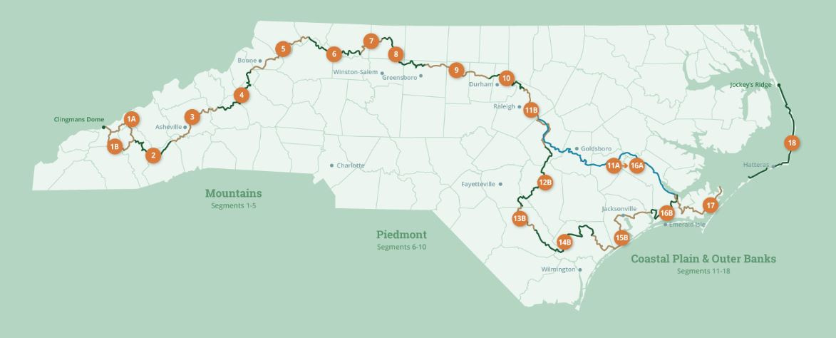
See the Mountains-to-Sea map at the bottom for reference.
I wake to the ducks calling my name. I am sure there is no way they know my name. Still their “quack” sounds a lot like “Jonathan” at 5 AM in the morning. This is supposed to be my “rest” day—or, at least, my morning to rest for a couple of hours. I had hoped to sleep in, if one can in a tent on hard ground with stones and sticks under me, but still, these ducks are like an old rooster—irritating.
My air mattress has deflated and I wonder if I didn’t close the valve correctly. Damn, the site is more rocky than I remembered it from last night. I sit up and decide to eat dinner from a dehydrated meal I have been carrying. Though I still have two mini-bagels, I’ll save them for tomorrow. The dehydrated meal doesn’t require hot water, but using the water I have from filling up at the convenience store the night before leaves me with a little less than a bottle of water remaining. I am thirsty and I know it is from expending so much energy yesterday. Still, I continue to drink my water.
I am already in Danbury, so I am not worried about water. When its time to get going, I’ll hike the mile-and-a-half back to the convenience store I stopped at last night and buy more bottles. Once past the store, I’ll be on the road following the Mountains-to-Sea Trail directions and continue my journey. But at that convenience store, I can’t help but wonder if I’ll see Hank or Bob Miller’s son. I hope not. Hopefully they’ll still be sleeping in the park
Reading ahead, the directions say I’ll follow the road for two miles through the town, then turn off for Hanging Rock State Park. A mile-and-a-half later, I’ll take the Indian Creek Trail for approximately two-miles straight up the mountain to the Hanging Rock Visitors Center. This is where Segment Eight of the MST ends. Roughly six miles total from where I am lying, and then, I will be at my campsite in the State Park campground and done for the day.
The only difficulty I’ll encounter is hiking 1,000 feet up the Indian Creek Trail to reach the Visitors Center near the top of the mountain. After walking so far yesterday, my idea is to save this climb for late morning. What I really want to do, in the meanwhile, is toss my meal’s dehydrated bits and pieces to the ducks and find a diner in Danbury.
I go to the men’s bath-house at the campground and am amazed at how unappealing it is with its dark, creepy toilet stalls, sinks with no mirrors, and tiny shower stalls without curtains. Black hair cover the shower drains, the shower heads shoot water in one hard jet stream out into the stalls, and I can find no difference between the hot and cold water nozzles even after standing for a number of minutes near the jet streams in several different stalls.
Still for twenty-five dollars and a campground welcoming me after nine P.M., I’m not going to complain. I slowly slide body parts into the water: first with my legs, then my arms, then the top of my head, and finally, sucking in my breath, I put my chest and face into the torrent of water and wash away yesterday’s story.


I go back to my campsite wondering if one could define that experience as a shower, and pack up my tent. I recognize it is around 7 AM but I am ready to go. I take note of the sign posted on the tree in front of the camp sites and call the first number listed. A man answers and says his wife runs the camp, but she is having surgery this morning. He wants to know if I can do a Venmo transaction later in the day when she is available to talk. I agree and wish her well, and, just like that, I am on my way for day three of my adventure.
Walking down the road it isn’t long before I discover a small restaurant on my left. I thought it was a river rafting outfit last night when I walked past, but I realize this morning it’s a family restaurant with a number of cars parked in front. I go in and am soon eating a great veggie omelette (even though I’m vegan) with hot home fries, buttered toast, and lots and lots of coffee.
As I stand to leave an old Vietnam vet at a table next to mine tells me he comes to the restaurant every morning. As I stand there, he tells me his story of getting up day after day in the torrential rain in Vietnam’s river delta. He said he enlisted, but didn’t expect that kind of weather. I tell him I was drafted, but the draft law ran out before the Army could call me up. I was fortunate, I say, as so many boys a year older had to serve. I am not sure how one fits with the other, but I say, “Today’s weather should be beautiful,” I reach over and shake his hand. “It’s a great day for hiking.”
The waitress fills my water bottles from the kitchen, and I can’t help but think this is a good omen for the day. Soon I am on my way down the road. Without taking a second to look at who might be hanging out at the convenience store I visited last night, I am back on the MST and hiking through Danbury.
I pass a building called the Arts Space and realize that it is a cafe too. I go inside and order two Americano coffees. I find a table near an electrical outlet on the wall and spend the next two hours charging my phone, watch and charger. The art work on the walls and the artistic items nearby give me a sense of well being, of me being in the right spot at the right time, so I don’t hurry to leave (and, in fact, call home to hear how everyone is doing). The building holds a stage for small assemblies and I can see immediately that I would frequent this place if I lived in this area.
Still, by ten AM I am ready to take on the challenge of hiking up Hanging Rock.


The two-mile trail is tough but a welcome stretch for my legs. It’s nice to be in the woods again, walking through thick rhododendron patches and lovely oak forests. I enjoy utilizing my legs and arms to climb up the quartzite rocks and steep ascents past Window Falls. Given the late morning hour, many day hikers and families with young children are walking to and from the observation areas around the Falls. I can’t help but wonder if anyone nearby is attempting the MST. In truth, I feel like a fish out of water. I think of those cowboy movies where the ranch hands come to town from weeks of herding cattle and how dirty they feel. Like them, I need a bath and saloon.


Instead, the Visitors Center is waiting for me. I have arrived at the end of Segment Eight. The ranger at the front desk is a young woman who couldn’t be more personable, and I like talking with her. My pack is on the floor next to me, and I am sitting on a nice easy chair enjoying the. respite. I eat my lunch consisting of a protein bar while noting a picture display of recent bear sightings in the park. The ranger tells me this year is the Year of the Bear in North Carolina. I thought it was the Year of the Trail, but she says that was last year. Later, she opens the gift shop for me and I buy two bags of Skittles at her suggestion and a bottle of orange Gatorade. The Skittles, she says, are great for hikes. I decide to save a many as I can for tomorrow.
The ranger wishes me luck with my journey and reminds me that hiking in the mountains takes a lot of water. She says, I shouldn’t assume it will be cooler either. People often think that hiking in the mountains is a way to avoid the heat, but, she says, it’s not. Just take it easy, stay hydrated, and pay attention to your body. I tell her of my new plan of being super, duper careful, but I don’t tell her of having walked nearly forty miles yesterday.
My camp site, a mile or so away from the Visitors Center reminds me of camping here a few years earlier with my daughter Helen and my dog Rosie. We had my vehicle with us and we used the campsite as a base for hiking the trails in the area. Helen had her own tent and Rosie slept with me. Rosie kept moving around all night and wanted to sleep on my air mattress. I don’t remember who ended up with the mattress, but I think it was her. These memories are a nice reminder of home and my call earlier. I’ll look forward to seeing Karen, Helen, and Rosie at the end of the day tomorrow.
My site comes with a bathhouse nearby. I take a long shower and shave and have no complaints about taking a second shower in one day. It’s kind of a nice way to backpack. I should find showers more often. I eat a mouthful of Skittles on that!
For dinner I eat the last of my mini-bagels, which were supposed to be for lunch. I decide to save my dehydrated meal for breakfast. All night my air mattress keeps deflating and I realize somehow I must have punctured it. I blow it up at least five times and wonder why I even bother.
At first light, I pack up my tent and am ready to follow the MST up Moore’s Wall to the lookout tower on Moore’s Knob, the highest point in the Sauratown Mountains at 2,500 hundred feet above sea level. This morning’s hike starts Segment Seven, and I am psyched to walk to Pilot Mountain twenty-four miles away.


I can’t stay long at the observational tower on Moore’s Knob and continue my trek over the mountain by taking the Tory’s Den Trail, which leads me down to the Sauratown Trail, an equestrian trail that will deliver me to Pilot Mountain and beyond.
The Sauratown Trail is twenty-five miles long and maintained by an association of nature lovers who created the route for horseback riders and hikers. Though some roads serve as connections, the trail runs primarily on private land from Hanging Rock to Pilot Mountain due to the generosity of local farmers and land owners.
The Sauratown Trail, rather than it being a wide path where two horses, say, could walk side-by-side, as I envisioned it, I discover is actually a narrow path that seems somewhat opaque in spots. A red ribbon tied to various trees branches denotes the trail, as does an infrequent use of the MST’s white circle blazes.
I enjoy the challenge of finally hiking this trail. I’ve known about Sauratown for some time, but never hiked the trail due to dogs not being allowed on it. Way back when I was walking with Rosie, my Border Collie, leaving her behind was a non-starter. I can see though, she would have loved hiking with me today. With the trail’s many streams and climbs, Rosie would have wanted to run on ahead. Still, given the narrowness of the path, I can see why horses and dogs would have a problem sharing it together.
Some spots, I begin to discover, are really remote. I mean really remote. I half expect to see a working still off in the woods and can only imagine being approached by the Hatfields or the McCoys with their long rifles keeping strangers from prying too closely. God forbid walking this section at night! One could disappear up here and no one would ever know where you were or, more likely, where you were buried.


Soon, though, I am hiking up Sauratown Mountain, the mountain between Hanging Rock and Pilot Mountain, but rather than directed to the pinnacle of this mountain, which is closed to visitors due to radio towers at the summit, I skirt around the mountain near the top, crossing a large rock field that seems the aftermath of a volcanic explosion which spewed thousands and thousands of rocks everywhere. Being on a horse working through this part of the trail, I bet, must be difficult and easy for your horse to injure a leg. That said, as a hiker needing to walk a total of twenty-four miles, I am extremely careful as to where I step as falling here would be awful and could have a significant impact on my journey.
I manage to stay upright, thank god, and walk down the backside of the mountain. I am soon in farm land where the pastures and vistas are magnificent. Though my goal is Pilot Mountain and its Visitors Center, what a beautiful hike I’ll have getting there.
This has been such an interesting walk: a minimum of roads, no convenience stores, no small towns or crossroads, just a hike through forests and farmland. In the course of the day so far, I’ve passed no one. I am simply on a quiet walk of nine-to-ten hours to contemplate my journey through North Carolina.
I am running low in water, once again, but my printed directions indicate I should stop at a barn ahead and replenish my bottles at a spigot on the far wall. I am happy to stop and the water tastes fresh and clean and is perfect to quench a thirst.


The hike has taken longer than I expect and I don’t arrive at the Pilot Mountain Visitors Center until close to five o’clock (rather than three or four). Another day of hiking ten+ hours. Karen has been waiting for me though, and I am delighted to see her. The Visitors Center does not sell Skittles or potato chips, but Karen has brought me two peanut butter and jelly sandwiches and I am in heaven. I have had an incredible four-days, and as we drive the highways around Winston-Salem and Greensboro, back to Durham, I can’t help but reflect on the opportunity I have been given: my health, the support of my wife and daughter, and the wonderful people and sights I have seen hiking Segments Eight and Seven of the Mountains-to-Sea Trail.
Click here to read the next chapter.
Click here to read the previous chapter.
Map of th eMountains to Sea Trail. This post focuses on Segments 8 & 7
Another amazing entry on your MST adventure. Today was all about solitude and serenity. These are two words I associate with you Jonathan. You remain the Camino Beast. ❤️ Marlene
Jonathan, what a terrifically epic tale. The interplay of tranquility and tension - the happy little coffee shop with a cabaret; the wide swathes of beautiful wilderness where you don’t see a soul for 10 hours – are interwoven beautifully. The shower scene – one body part at a time – was hilarious, as was the perennially flaccid air mattress that flatlined at 4 AM. Really well paced and vivid and I was right there with you. Man, I admire you for doing such an epic trip. 40 miles in one day! I couldn’t do it. I just couldn’t. But at least I had your wonderful collection of pieces to read. Next, you should book a luxury cruise on the QE2 to Tahiti.