
The Balsams
MST. Chapter 45

This is my serialized story of hiking the Mountains-to-Sea Trail (MST), a 1,175-mile route that crosses the state of North Carolina. I’m hiking west from Jockey’s Ridge near Nags Head on the Outer Banks of the Atlantic Ocean to the top of the mountain known as Kuwohi (formerly Clingmans Dome) near the Tennessee border in the Great Smoky Mountains. If you’d like to start at the beginning of my story, click here.
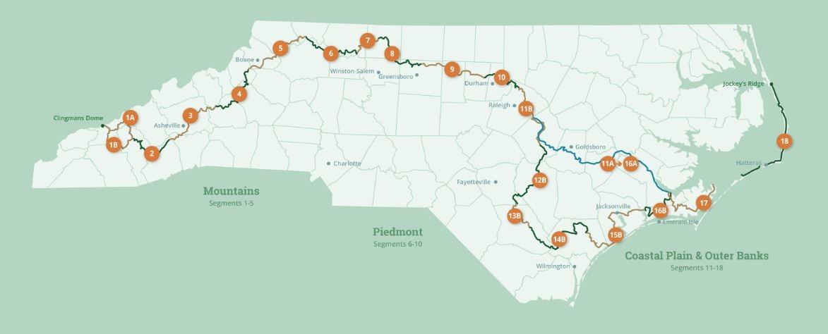
See the Mountains-to-Sea map at the bottom for reference.
A week before beginning cancer treatments, I depart for the Balsam Mountains in Western North Carolina. I am about to undertake a five-day/four-night, sixty-three- mile hike before it’s too late—after all, my cancer has been percolating and growing ever darker inside me. It’s late September and, given my situation, the clock to complete the Mountains-to-Sea Trail has run out. Still, if I’m lucky and don’t die on the trail due to the toxic bowl of witch’s brew bubbling below my belly—I’ll be able to complete one of the most critical segments.
A subrange of the Blue Ridge Mountains in the Southern Appalachians, the Balsams lie between the Great Smoky Mountains on the Tennessee border and the Black Mountains east of Asheville. The Balsam range is famous for its peaks of over six thousand feet, which include some of the highest points east of the Mississippi, such as the Richland Balsam (6,410 feet), Black Balsam Knob (6,214 feet), and Cold Mountain (6,030 feet).
For the most part, lying inside the Nantahala and Pisgah National Forests and the Middle Prong and Shining Rock Wilderness Areas, the Balsams are actually as far removed as I can manage from the overwhelming medical verdict regarding my life.
Ginger, my good friend and hiking partner, has agreed to accompany me into the Balsams. This is her second thru-hike and I am relieved it’s with me—though I’m not sure if she knows she might have to carry me out. Still, I can’t help but wonder if she made a financial pact with my wife to make sure I come home.
After all, a large cylinder, linear accelerator, known as Big Yellow, is warming up at the Cancer Center for me and will shoot a high intensity beam of radiation straight into my poor pelvic floor every day for the next month.
Just like Hurricane Helene destroyed the trails in Western North Carolina a year ago and, now, those same trails are finally opening to long-distance hikers, so too, for more than a year prostate cancer and other ailments have plague me. Besides for the four months it took to recover from a radical prostatectomy back in February, I then sustained a knee injury early in the summer, which pretty much kept me from walking let alone hiking with a backpack. Now, some radiation oncologist has pumped two shots of a horrible drug into my butt to stop my healthy cells from making testosterone—and, god forbid, who knows what the side effects of that will be.
However, prostate cancer cells, I’ve been told, feed on testosterone. These deviant little buggers could care less that my knee no longer hurts and the brace I wore on my previous hike has been tossed to the back of the closet.
Without those butt shots, they would love what I’m about to embark upon. I’ve read that the body makes more testosterone when it’s being physically challenged, and this hike will definitely be an intense challenge: climbing up and down thousands of feet a day for five days with a thirty-pound pack.
Make that more shots in the ass, please!
In truth, I’ve gotten to the point where I don’t care.
I just want to be deep in a forest—lost in thousands and thousands of acres of trees. I’m dying to be far removed from roads that lead to hospitals and clinics, from prodding doctors and recurring medical prognoses, and nowhere near the many side effects that could be, might be, life-long and life-changing.
It dawns on me as I drive the four hours to meet Ginger at the Pisgah Inn, the eastern terminus of our hike, I don’t want to come back. I wonder if I should tell Ginger.


Ostensibly, our plan is to leave Ginger’s car at the Pisgah Inn and drive my car to the start of the trail. We need to begin our hike by noon in order to reach the first campsite listed in the MST guidelines before dark. We are, however, courting trouble when Ginger realizes in searching her car that she has forgotten her hiking poles. Fuck! I immediately suggest we drive to Asheville to find a hiking store, but Ginger wants to check the Inn’s gift shop first—a decidedly long-shot.
To my shock, the Inn sells for their guests both walking sticks and hiking poles. I am truly flabbergasted, but as the saleswoman says, “This is not our first rodeo.” Indeed. We’re relieved and thrilled. We may make our noon deadline after all.
As we drive to Waterrock Knob, the start of Segment Two, Ginger studies the MST guidelines and says, “You know, though we only have nine-and-a-half miles of trail to hike today, it says here that the campground is an additional mile-and-a-half away.”
My heart sinks. I was hoping the commercial RV park and campground would be right off the trail. We’ll be pushing to make it in daylight. With a sudden feeling of anxiety, I can just hear those little cancer cells chomping away.
We reach Waterrock Knob at nearly six thousand feet and quickly push to get on the trail. I remind myself while at the car to take a moment to be sure I have everything I need beyond my thirty-pound pack. Transitioning to the trail is always disjointed—exciting and anxiety-prone—and this hike proves to be no different.
This time, I remember to turn on the GPS unit on my backpack and the tracker on my watch, and am quite proud of myself—until I realize I have forgotten to bring handkerchiefs from home. As I am at the end of a cold, I’ll be blowing my nose into dried-out maple and oak leaves that I pick up off the trail for the next five days. Ugh!
Descending 2,000 feet on the east side of Waterrock Knob—especially in clear, cool hiking weather—proves to be easier than climbing up the westside, which we did at the end of our last hike, and soon we are off the top of the mountain and walking along the Blue Ridge Parkway. Even later, for two easy miles we move quickly down on an old dirt road. The trail goes back into the woods, but still, we are making good time. We reach the Balsam Gap at the nine-and-a-half mile mark at five-thirty, but it’s here where things get confusing as we search for directions to the Moonshine Creek Campground. Finally, Ginger opens Google Maps on her phone and, after checking it several times, says in frustration, the campground is actually a mile further than the mile-and-a-half distance listed in the guidelines.
We leave the MST behind and begin the two-and-a-half mile trek down a long, long, never-ending road. I’m behind Ginger, who is following her Google maps app. I can’t imagine doing this part of the walk without her. If we had a rope, I would tie it around my waist and have her pull me along. Where’s my testosterone when I need it?
At around six-thirty we arrive at the campground and I am dog tired. My feet hurt and I want to take my boots off. I’ve been up since three-thirty this morning and, I must admit, I need to rest. Hopefully Ginger hasn’t noticed, but I have lost my stamina.
The campground, though, is nice and soon we have our tents up and make dinner of rehydrated lasagna on my little burner at a picnic table. The meal is hot and I am truly relieved and thankful that this day is over.


In the morning we are up early and fortunate to have the manager’s husband drive us up the hill to where we left the trail. What a wonderful gift! To have to walk nearly three miles before we could start our hike on the MST would have been awful—especially as we leave the Balsam Gap (separating the Smoky Mountains from the Balsam Mountains) and begin climbing to nearly 5,500 feet.
We are thrilled to be in the forest as we ascend our first mountain. After eight miles though— having climbed two thousand feet over rough boulders and up steep switchbacks—we take a much needed break by following a short spur to the Glassy Ridge Mine Overlook on the Blue Ridge Parkway. A lunch of power bars at a cement picnic table proves to be a perfect place to rest.
Ginger notices that we have cellular service on our phones for the first time since starting our hike She leaves a message for her husband while I call home. It’s nice talking to my wife Karen, who warns that the forecast is calling for rain tomorrow—fortunately, unlike most fronts that cross into North Carolina from the West, this front is coming in from the Atlantic Ocean. I say, “Hopefully, being in the western most part of the state will have its advantages, especially if the storm moves north.”
By one in the afternoon, after taking pictures of the beautiful vista, we are back in the woods. Three miles later we leave parkway land and enter the Nantahala National Forest where primitive camping is allowed for the next fourteen miles.
Our hope is to maintain a pace of fifteen miles a day, but the hike is proving to be either tougher than we imagined or I am totally out-of-shape. In the late afternoon we stop to filter water at a small stream cascading down the mountainside—for me, to refill my two one-and-a-half-liter water bottles and for Ginger to replenish her two-liter Camelback pouch that rests in the back of her backpack. The time spent sitting next to the stream is welcomed.
We are only two miles inside the Nantahala National Forest but are already talking about where to stop for the night. A mile later we take advantage of a nice level, grassy campsite. It’s only five o’clock, but the next site is listed as approximately three miles ahead—likely more than an hour away. I am not sure if its me or the cancer, but the desire to stop is overwhelming.


The next morning we are up early, once again. We want to cover some distance today. Certainly the idea of hiking fifteen miles is critical both to maintain our pace and to set up our tents in a designated camping area—as opposed to land prohibited by the Park Service. The next critical objective, then, is to reach the Pisgah National Forest.
This trail continues a pattern of hiking along the ridges of the Balsam Mountains, dropping a thousand feet and then climbing back up to five thousand feet. Our pace averages between two miles-an-hour to two miles every hour-and-a-half. It’s clear, reaching fifteen miles will take longer than we expected.
However, the hike is spectacular with red spruce trees filling the forest canopy and rhododendron, such as mountain laurel, and an assortment of blooming mountain flowers thriving on the forest floor. It’s tough not to stop along the way and take in the moment. In truth, we have arrived at exactly where I had hoped to be—deep in the forest. I don’t want this moment—this hike—ever—to end. Couldn’t I lie down here on moss-covered rocks, next to a cascading stream? Couldn’t Ginger take it from here?
Twelve miles later we come out of another beautiful stand of spruce trees to cross the Blue Ridge Parkway. It’s three in the afternoon and a perfect spot to rest for a few minutes. No picnic tables but the guard rail works perfectly fine for my feet.
The view at Haywood Gap, about thirty feet away, is fabulous. I join a woman whose car is parked alongside the road. She is busy taking pictures. She tells me she is focusing on the thousands of butterflies in the meadow in front of us. I realize that I have been so enamored studying the mountain vista that I did not see the butterflies almost on top of me. Yet, these butterflies are part of the intimate details that truly matter on such an incredible day.


Shortly I say goodbye to the lady and her butterfly-coveted meadow. We cross the Blue Ridge Parkway with its swarm of speeding cars, and enter the Pisgah National Forest. This is our objective for the day and where, once again, camping is unrestricted. The silence of the forest is a welcome reprieve from the busy parkway.
Two miles later we reach the Middle Prong Wilderness Area, one part of our nation’s most protected heritage. Managed by the Forest Service, a wilderness area is a designated portion of the forest that can’t be touched for multi-use purposes. For us, entering this area is sacred, and we can’t help but feel privileged to be here. I swear, the forest has a shimmering glow from the sun shining through the trees. The whole area is God-like. Soon, we find a gurgling stream running down the mountain side and take time to rest and, once again, filter our water sources with cold, clear water.
A mile later we find a spot to camp for the night. It’s a good time to settle in, with dusk upon us, and enjoy our second hot meal of rehydrated lasagna. Clearly, for us both, this meal is a hit! For once, I am not thinking about next week. Rather, I am killing cancer by being alive here, now, at this very moment.


We get up at daybreak for our last full day of hiking, recognizing that we have a tough goal ahead. In addition to climbing to the top of Silvermine Bald, listed at nearly six thousand feet, we’ll need to complete a seven-mile hike through what is known as Graveyard Fields, where camping is prohibited due to active bears in the area. The test will be to reach the Blue Ridge Parkway on the other side of the Fields. Even then, camping is prohibited until we are back, once again, in the Pisgah National Forest.


It’s an eight-mile hike to reach the Graveyard Fields. We plan to maintain a pace of two-miles-an-hour—which we realize is wishful thinking in climbing Silvermine Bald. Late morning we stop for a quick lunch at a junction with the Little Sam Trail running catty corner to the MST and, shortly thereafter, encounter two young hikers arriving at the junction from the diagonal trail.
Seeing us, the hikers stop for a breather. I ask about the SAWS logos on their sweatshirts and am told they are part of the Southern Appalachian Wilderness Stewards (SAWS) and, in fact, are hiking the Little Sam to determine how much the trail has been impacted due to recent storms. SAWS, they tell us, seeks to protect the wild public lands of the Southern Appalachians. These two are in the middle of a two-year commitment, spending their days hiking the trails in the area. I want to cry. How I wish I had the freedom and the health to commit to such an endeavor!
A mile later we have climbed to the top of Silvermine Bald. The clouds part briefly and the view is spectacular. As I take pictures on my phone, Ginger says we have cell service, once again. I call Karen and discover it is raining hard where we live in the middle of the state. I tell her it isn’t raining here, but with dark clouds moving in, I wonder if we might see rain soon.


On the top of Sivermine Bald we meet up with the Art Loeb Trail and find ourselves sharing the trail down to Black Balsam Knob Road where we’ll begin our hike through the Graveyard Fields. In North Carolina, the Art Loeb Trail is a famous trail and one that I have thought about for years. Covering thirty miles with elevational gains of eight thousand feet, the Art Loeb touches numerous peaks in the Balsam Mountains. For now, it’s kind of cool to be on it for one small section of our hike.
For me, the thought occurs to me that we could give up the MST and hike the Art Loeb Trail. I wonder if Ginger would be up for thirty more miles hiking peak to peak?
When we reach Black Balsam Knob Road, we are surprised to see numerous cars parked near the trailhead. In talking to hikers coming off the trail, it isn’t hard to realize that these people are day-hiking this section of the Art Loeb and no one is coming from the MST—especially not with active bears in the Graveyard Fields.
It’s early afternoon, and, if we stay on the MST, we will still have miles to go.


I think “if” as this is my moment to spring free of our fixed five-day/four-night hike and take the freedom of a truly open trail. Oh, how I wish I was the type of person who could shift like this, to tell the doctors next week to go fuck themselves—wouldn’t it be wonderful. But, deep down, deep, deep down, I can’t. I can’t. I want to live.
We turn right and follow the signs to the Graveyard Fields, which is not nearly the “fields” we expect. In fact, I half-considered the fields to be like the Barrow-downs in J.R.R. Tolkien’s Fellowship of the Ring—burial mounds from an ancient battle. If we too become lost, perhaps a Tom Bombadil would save us.
Instead, the Graveyard Fields are named after the hundreds of dead tree stumps that have become covered in moss and vines and now look like ancient tombstones. Hiking across the “fields” we push over glacier-settled boulders, pass red maples and evergreens saplings, and cross numerous dry water beds, but never do we encounter a phantom, or barrow-wright, or even an active bear to impede our journey.
By mid-afternoon, after hiking through the Fields, we realize we need to find water and decide to reach Skinny Dip Falls to replenish our supplies.


A little after four we arrive at the Skinny Dip Falls and are amazed at how significant the falls are—a tumbling flow of water breaking over large boulders down a sharp hillside. Pictures on our phones don’t do it justice. We climb down to the base of the falls to filter water as well as eat protein bars and sports gummies. We will need to get energized for the miles to come. A careful crossing of the rushing water through the jutting rocks takes time, but neither Ginger or I want to fall into the water with our packs or get our boots soaked.


An hour later we climb up to the Blue Ridge Parkway and take another short break at the Cherry Cove Overlook. If left to me, I would put up our tents here, but Ginger reminds me that camping on park land is prohibited. We must continue our hike to get back into the Pisgah National Forest—even with storm clouds brewing overhead.
After climbing numerous hills, we cross into the national forest three miles later. Our hope was to find level ground right away to set up our tents. But with dusk now upon us and rain starting to fall, we don’t have time to hike to the campsite listed in the guidelines approximately four miles ahead. Instead, we find a gradual downward slope in the forest and pitch our tents here. Shortly thereafter the rain begins in earnest. We quickly get into our tents, forgoing dinner, and fervently hope in the ensuing darkness that rivulets of water working their way down the hillside won’t find a path into our thinly protected shelters.


It’s a horrible twelve hours with heavy rain pelting our rain tarps. Persistent streams have wormed their way inside our tents, and I have spent the night trying to plug these emerging sources to no avail. Soon most of my sleeping bag is soaked and my feet are pushed up into a fetal position near my chest. I am like a swamped rat: nearly everything is wet. But if it comes down to protecting one thing, I want dry socks.
In the morning we pack up in the rain and get started as quickly as possible. Ginger’s night as been equally bad and neither of us have much to say. My boots are absolutely soaked and it isn’t long before my socks—which I worked so hard to keep dry—are soaked too. However, it’s only seven miles to the Pisgah Inn—only seven miles. Still, hiking in a forest in rain seems to take forever.
Finally, we reach an insane series of switch backs composed at each turn of large rocky, slippery steps which ultimately leads us up to the Blue Ridge Parkway and the end of our hike, the Pisgah Inn.
We are exhausted when we come out of the forest and pass the Adirondack chairs on the back manicured lawn of the Inn, but we are elated too. It’s midday and, I realize, we started at midday five days ago. Now here we are—more than sixty miles later.
Ginger has reserved a room at the Inn and we change into dry clothes that we left behind in the back of her car. Shortly thereafter, we celebrate by sitting in the dining room and eating a wonderful lunch with lots and lots of black coffee.
We talk about the last few days and Ginger confesses that she did not find the overall experience of thru-hiking in the Balsam Mountains to be that much fun. She suggests she would have preferred a series of day-hikes as opposed to one long push and I understand. Many hikers complete the Mountains-to-Sea Trail in such a manner. It’s just not how I chose to tackle the MST segment by segment. Even now, so close to the end, I say almost as an apology, “I’ve walked too far to change.”
I realize that I should not have said that. Successful long-distance trails dictate being flexible. Perhaps Ginger and I could have undertaken a series of day-hikes through the Balsams—that too could have been fun. But I didn’t have that kind of time. Radiation and months of hormone therapy wait for me at the start of the week.
At around two in the afternoon, Ginger drives me to my car parked at the Waterrock Knob Visitors Center. A long time ago we sat here at the finish of our hike from Kuwohi in the Great Smoky Mountains and just five days ago this is where we began our hike.
It’s sort of sad standing at my car. I share oranges with Ginger that I left on the back seat of my car. It’s not champagne, but it feels like a toast.
Ginger returns to the Pisgah Inn, and I drive the five hours home a little depressed. I had a golden opportunity hike the Art Loeb Trail, to deviate from the norm, to do the unexpected, to follow a different path—I am such a charlatan.
Ginger’s pictures from the Inn the next morning are stunning. To think we were in the thick of those mountains is mind-boggling. To think we won’t be back anytime soon is simply awful.


Monday I report to the Cancer Center for the first of twenty rounds of radiation. The day before I started taking a daily hard-core drug, Abiraterone, which is supposed to eliminate all the remaining testosterone in my body. Between the radiation and the Abiraterone, I am about to decimate my pelvic floor and everything surrounding it.
As I pull down my pants and underwear and lie in the “Yellow” cylinder that will pinpoint a tight beam of radiation through a small towel covering my private parts, I cannot help but force myself to leave my body: I spot the MST, the long hikes, the incredible vistas, as well as a lovely meadow of fluttering butterflies. I don’t feel the heat of radiation from the linear accelerator or the queasiness of the drug I took earlier, only a deep, deep urge—no, rather an intense longing rising up from the depth of my devastated core—to return to the magnificent spruce forests of the Southern Appalachians and rediscover myself in the majestic peaks of the Balsam Mountains.
The mountains-to-Sea Trail. This chapter focuses on Segment Two as I flip-flop my hike. With the impact of Hurricane Helene closing Segment Three and parts of Four, my goal is to tackle as much of the remaining segments as I can before receiving treatment for prostate cancer.
I always enjoy reading about the progress of your hikes (and cancer skirmishes. ) May the former always take up more of your brain brain than the later.
I hope your treatment goes well, Jonathan, and that you will be back on the trail in record time.