Shade, Shade, Shade
MST. Chapter 3. Segment 18 (Part 3)

This is my serialized story of hiking the Mountains-to-Sea Trail (MST), a 1,175-mile route that crosses the state of North Carolina. I’m hiking west from Jockey’s Ridge near Nags Head on the Outer Banks of the Atlantic Ocean to Kuwohi (formerly Clingmans Dome) near the Tennessee border in the Great Smoky Mountains. If you’d like to start at the beginning of my story, click here.
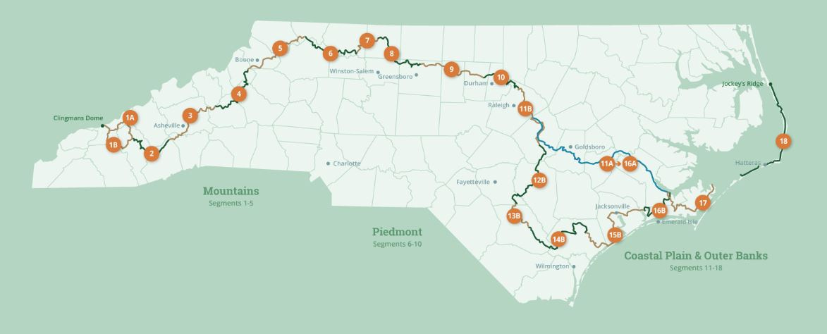
See the Mountains-to-Sea map at the bottom for reference.
Day two starts by walking the three-mile bridge over the Oregon Inlet, connecting Bodie Island with Hatteras Island. With cars and tractor trailers speeding by me, I can’t help but wonder what the hell I have gotten myself into.


At the historic life saving station I spot the first marker for the Mountains to Sea Trail. What a relief!
With new enthusiasm, I cross the spectacular dunes and begin my four-mile journey up an empty beach. Following an app of the route, I am led off the beach to undertake a three-mile walk across the Pea Island National Wildlife Refuge. I am glad to leave the beach though, and, interestingly enough, while crossing the dunes to the refuge, I meet an older couple who are completing their MST journey. We swap stories standing deep in sand, but, as I am only in my second day, I mostly listen.
Paul and Shirley are from Western Carolina and have spent years off-and-on completing the 18 segments of this trail. Though my goal is one year, I am starting to understand how tough this is going to be.


At the Pea Island Visitors Center I buy a bag of Lays Classic chips and a Nature Valley crunch bar and swig it all down with Gatorade. My daughter had said earlier my plan for eating lunch on the MST was horrible and now, here I sit, day two, with the lack thereof staring me right in the face as I prepare for a ten-mile hike up the beach.
The hike taken reluctantly (and not pictured) nearly kills me, carrying a thirty-pound backpack in sweltering heat and an unrelenting sun, and, to top it off, I run out of water around the eighth mile. The good news, in my struggle to find firm footing, I didn’t get my shoes wet this time. Though I may die of dehydration, my shoes will be dry!
By mile nine, I cut off the beach, cursing anything to do with sand, and crawl to a gas station. I sit for an hour in the shade drinking a bottle of coconut water a food truck vender gives when he sees the wrinkled grape of a person I have become. He says he spotted the better me on the bridge that morning. The me who walked robustly into the jaws of death.


Luckily, my campground, at this point, is only two miles away. The only request I make at the front desk, after finally replenished enough to start walking down Rt 12, is shade. Shade, shade, shade.
My day ends, then, in shade with my little tent huddled amongst massive RVs. I don’t care as all the other tent sites are in bright sun near the dreaded beach. Lots of water and a shower, a home cooked meal of hot water in a dehydrated packet of noodles, followed by a good night’s sleep, and I am ready for day three.
Click here to read the next chapter.
Click here to read the previous chapter.
Map of the Mountains-to-Sea Trail. This post focuses on Segment 18.