

This is my serialized story of hiking the Mountains-to-Sea Trail (MST), a 1,175-mile route that crosses the state of North Carolina. I’m hiking west from Jockey’s Ridge near Nags Head on the Outer Banks of the Atlantic Ocean to Kuwohi (formerly Clingmans Dome) near the Tennessee border in the Great Smoky Mountains. If you’d like to start at the beginning of my story, click here.
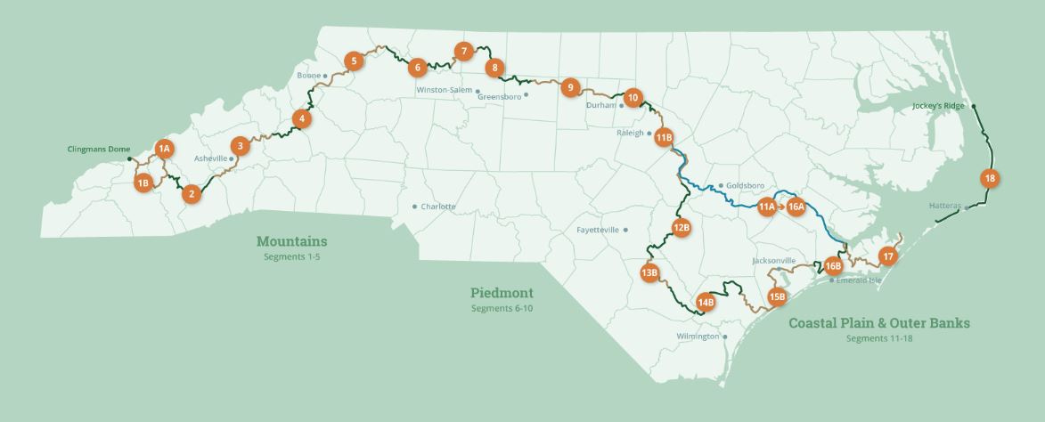
See the Mountains-to-Sea map at the bottom for reference.
Day 4 starts by leaving Frisco Campground for a seven-mile hike up the beach to meet the ferry at Hatteras. Soon it will be off to Ocracoke, the last island of my Outer Banks portion of the Mountains to Sea trail. At the ferry terminal, while I am waiting for our departure, a member of the ferry staff tells me the village of Ocracoke is 13 miles from where the ferry docks, but if I want to wait for the passenger ferry, it goes around the island to the village. I ask, when does it leave and she says May 12th.


On the ferry crossing I meet Roger and Vanessa who were also staying at the Frisco Campground but are riding their e-bikes to Ocracoke for the day. Roger tells me he has walked the Maine and New Hampshire portions of the Appalachian Trail and said it was really tough. I should keep that in mind. He is a talker and goes on to tell me about biking with his son across the US. - 40 days and 42 flat ties. I listen and marvel at his stories, but I really want to go to sleep for the hour ride. I am facing at least ten miles of beach walking before I reach the village. Roger’s one admonition of walking into Ocracoke that I mull over is “Don’t expect anything but a lot of nothing” before getting to the town. The island of Ocracoke is pretty much a protected wildlife refuge.
Hitching up my “big boy pants” and tightening down the straps on my backpack, I head down the sandy access road to the Ocracoke beach only to be met by a man who ask if I am walking the MST. The guy looks like he has seen a hurricane or two. He says he’s the Mountains to Sea coordinator for the Ocracoke area and warns me that several large sections of the beach are closed to all foot and vehicular traffic due to the Spring nesting of seabirds. He advises meI to walk the road than climb over the dunes each time I reach one of these sections. Given he looks - and talks - like Ahab in Moby Dick, I retrace my steps, which in sand is not easy to do, and take to the road, beginning my thirteen mile hike a little disappointed and a little relieved too.
Soon though, I am in a sand storm. A strong and constant wind is pushing sand from the dunes across the road and I am walking through the middle of it all. Just one more thing on this adventure, I tell myself - no sweat. Except, I am getting coated in sand. I put my bandana over my mouth, but my ears feel like cauliflowers.


The road to Ocracoke takes forever (4 and a half hours) and walking along the side as cars and SUVs whine past, a harbinger of things to come, I suspect, as I make my way across the state. This time, though, waiting for me in the village of Ocracoke are Karen and Helen, who are staying in an Aiirbnb during this portion of my hike. I am exhausted but thrilled to see them. After a shower, rest, and Gatorade, we go out for burgers and fries and I add a ton of catchup to mine and I am in heaven. The next day, too, I take off from the trek to wash clothes, restock, and sink into breakfast burritos with bottles of orange soda! Marvelous! Simply marvelous.
Click here to read the next chapter.
Click here to read the previous chapter.
Map of the Mountains-to-Sea Trail. This post focuses on Segment 18.
Thanks Jonathan for sharing your MST journey. The hiking on the sand must be extremely challenging. I am so proud of you. Keep charging!